What Is La Niña?
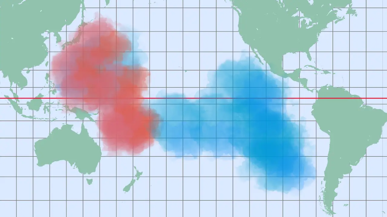
La Niña is the cold phase of the El Niño–Southern Oscillation (ENSO). It occurs when sea surface temperatures in the central and eastern Pacific Ocean are cooler than average. During La Niña, strong trade winds push warm water westward toward Asia, allowing cold, nutrient-rich water to rise along the coasts of the Americas.
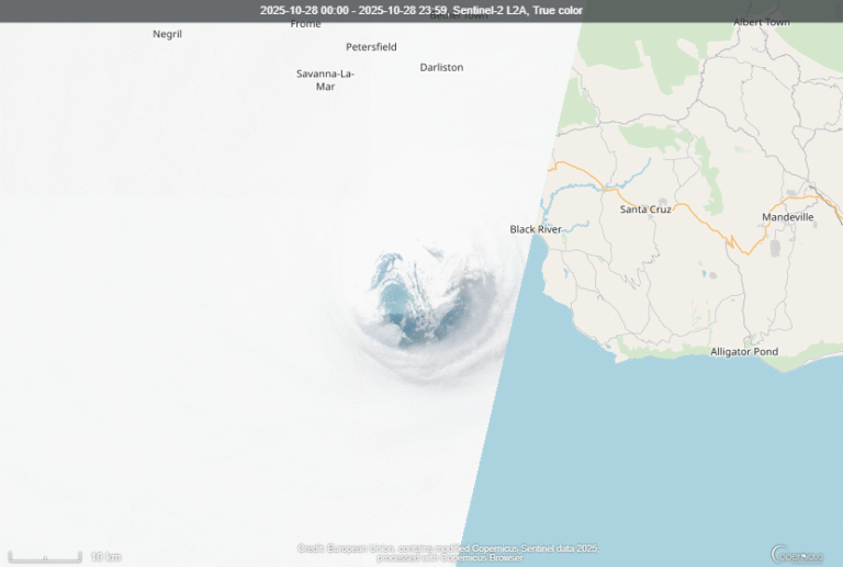
This process changes air pressure patterns and shifts the global jet stream. As a result, northern regions often see wetter and cooler winters, while the southern United States and parts of South America experience drier, warmer conditions. These changes can also make Atlantic hurricane seasons more active and destructive.
How La Niña Got Its Name
The terms El Niño (“the boy”) and La Niña (“the girl”) were first used by Peruvian fishermen centuries ago. They noticed that the ocean sometimes warmed around Christmas, causing fish to disappear. Scientists later recognized the cooler opposite phase — La Niña — and by the mid-20th century, researchers like Gilbert Walker and Jacob Bjerknes connected these changes to global weather patterns.
La Niña typically appears every 2 to 7 years and lasts 9 to 12 months. In rare cases, it can persist for several years, known as a triple-dip event.
The Rare Triple-Dip La Niña Events
Since the 1970s, only three triple-dip La Niña events have occurred: 1973–76, 1998–2001, and 2020–2023.
The 1998–2001 event cooled global temperatures and caused major flooding in southern Africa and drought in western North America. The most recent La Niña from 2020–2023 surprised scientists because it wasn’t preceded by a strong El Niño. It brought record-breaking floods in Australia and Pakistan, drought in the Horn of Africa, and intense hurricane seasons in the Atlantic. These extreme years challenged forecasting models and revealed how complex ENSO has become in a warming world.
Global Weather Impacts
La Niña affects rainfall patterns worldwide. Southeast Asia, Indonesia, and northern Australia usually experience heavy rain and floods. In contrast, East Africa and parts of South America often face severe drought.
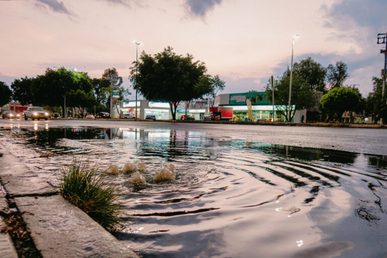
In North America, northern regions get more snow and rain, while the southern plains and the U.S. Southwest turn dry. Agriculture, fisheries, and economies all feel the impact. While some regions benefit from cooler, wetter conditions, others suffer devastating losses — like the 2010–11 famine in East Africa or the massive floods in Australia in 2010.
Environmental Effects and Ecosystems
The cooling effect of La Niña strengthens ocean upwelling, bringing nutrients that boost marine life such as anchovies, squid, and salmon. This helps revive fisheries along the Pacific coast of South America.
On land, the picture is mixed. Drought can spark wildfires and dust storms, while excessive rainfall causes flooding, erosion, and habitat loss. The environmental consequences are complex and far-reaching, affecting both land and sea ecosystems.
La Niña in a Warming Climate
Although La Niña is a natural climate cycle, global warming is changing how it behaves. Recent La Niña events have been weaker and shorter, and they no longer cool the planet as much as before. Scientists suspect that rising global temperatures are shifting the balance of ENSO events.
To improve forecasting, NOAA — the U.S. National Oceanic and Atmospheric Administration — is developing a new Relative ENSO Index. This index adjusts for modern temperature baselines and helps identify ENSO patterns more accurately in a warmer world.
Forecasting and Climate Preparedness
Detecting La Niña early is essential for climate preparedness. Governments, farmers, and disaster agencies use ENSO forecasts to plan for floods, droughts, and storms. New detection tools, such as RONI (Relative Oceanic Niño Index), help scientists track multi-year La Niña events and predict their impact with greater precision.
By improving early-warning systems and long-range models, the world can better adapt to La Niña’s growing influence on global weather and climate resilience.
A Cold Event with Hot Consequences
So La Niña may be called “the cold event,” but its effects are anything but mild. It shapes weather patterns, drives natural disasters, and influences ecosystems worldwide. As the planet continues to warm, understanding La Niña is more important than ever.
Stay informed, stay prepared — and if you want to learn more about how Earth’s climate works, explore our deep-dive on El Niño, the other side of the climate seesaw.