What we now know about Hurricane Melissa

Hurricane Melissa devastates Jamaica:
What We Know

Jamaica – Wednesday, October 29 

Hurricane Melissa has left a path of devastation across Jamaica, after making landfall on Tuesday, October 28, as a Category 5 hurricane. With sustained winds reaching 185 miles per hour (297 km/h), it became one of the most powerful storms ever recorded in the Atlantic Ocean.

Satellite images reveal the eye of the storm

New satellite imagery from Sentinel-2 L2A shows the hurricane’s eye just off Jamaica’s southern coast, moments before landfall. The images highlight the storm’s perfect symmetry, a clear sign of extreme intensity, as Melissa roared across the island.

Article continues after image.

Massive destruction across the island

The impact has been catastrophic. Power lines were torn down, homes were flattened, and roads are now blocked by fallen trees and debris. Over one-third of Jamaica’s population is still without electricity, and communication networks remain down in several parishes. Entire neighborhoods in St. Elizabeth and Manchester have been submerged after torrential rain caused severe flooding.


Prime Minister Andrew Holness described the situation as “a national disaster unlike anything we’ve faced in decades.” Rescue operations are still underway, with emergency shelters housing thousands of displaced residents.


How Hurricane Melissa formed

Melissa started as a tropical disturbance off the coast of West Africa roughly two weeks ago. As it moved westward across the Atlantic, it entered the warm waters of the Caribbean Sea. The combination of unusually high sea-surface temperatures and weak wind shear created ideal conditions for rapid intensification. Within just a few days, Melissa evolved from a tropical storm into a catastrophic Category 5 hurricane.


What happens next

As of Wednesday morning, the storm is moving northwest toward eastern Cuba and the Bahamas. Although gradual weakening is expected, forecasters warn that Melissa remains extremely dangerous, bringing life-threatening rainfall, flash floods, and storm surges to the northern Caribbean.


Meteorologists will continue to monitor the storm’s track closely. For now, Jamaica begins the difficult process of recovery from what could become one of the most destructive hurricanes in its modern history.

Read More

What we now know about Hurricane Melissa

Hurricane Melissa, one of the strongest Atlantic storms ever recorded, has devastated Jamaica before moving toward Cuba and the Bahamas...

Iceland’s First Mosquitoes: Will They Survive?

For the first time in history, wild mosquitoes have been discovered in Iceland — a place long known as one of the few mosquito-free countries on Earth. The finding has surprised scientists and sparked...

How does La Niña affect the world in 2025?

La Niña is back! But what exactly is La Niña? Around the globe, climate patterns swing between two powerful forces: El Niño and La Niña. These events influence weather everywhere — from devastating...

Iceland’s First Mosquitoes: Will They Survive?

Iceland’s First Mosquitoes: Will They Survive?

For generations, Iceland has been famous for many things — volcanoes, glaciers, geysers, and clean Arctic air. But one thing it never had was mosquitoes. The island’s harsh winters and unpredictable weather made it one of the very few mosquito-free countries on Earth. That record, however, may have just come to an end.


In October 2025, scientists confirmed the discovery of the first wild mosquitoes ever found in Iceland. The news sparked worldwide interest, not because three insects pose a health threat, but because of what they might symbolize: a clear biological sign that even the Arctic is warming fast.

Article continues below the video.

The Discovery That Surprised Iceland

The mosquitoes were discovered north of Reykjavík, in the small municipality of Kjósarhreppur. They were caught by a local resident who noticed them buzzing around during an unusually mild autumn. Using a homemade wine trap — a simple method involving a rope soaked in red wine — the resident caught three specimens: two females and one male.


Entomologist Matthías Alfreðsson from the Icelandic Institute of Natural History later confirmed their identity as Culiseta annulata, a cold-tolerant species widespread in northern Europe. Until this finding, no mosquito species had ever been proven to survive naturally in Iceland.


For scientists, this discovery was more than a curiosity. It challenged a long-held belief that Iceland’s constant freeze–thaw cycles made mosquito survival impossible. Traditionally, the country’s temperatures drop below freezing in autumn, then rise just enough to thaw the ground before plunging again — a deadly pattern for insect larvae that need stable conditions to mature.


How Did the Mosquitoes Reach Iceland?

Researchers think the mosquitoes probably didn’t fly there on their own. Instead, they likely hitched a ride on ships, airplanes, or within imported cargo. Iceland relies heavily on international trade, and global shipping routes constantly connect it to Europe and North America. It is easy to imagine mosquito eggs or adult insects hidden in vehicles, containers, or even damp machinery.


However, climate conditions are now making these accidental arrivals more successful. In the past, any mosquito that made it to Iceland would have perished within days. Now, with milder summers and fewer freezing nights, they have a short window to reproduce. Warmer weather allows eggs to develop faster, and standing water — often formed after heavy rainfall — provides the perfect nursery for larvae.


According to Alfreðsson, this may be the result of a “threshold shift.” Iceland’s climate has not become tropical, but it may have warmed just enough to let cold-tolerant species like Culiseta annulata survive, at least temporarily.


Can They Survive the Icelandic Winter?

Whether these mosquitoes will return next year is the big question. Survival through the winter would mark a turning point.


Culiseta annulata is known for its toughness. In countries like Norway and Scotland, the species hibernates in barns, stables, and basements, waiting for spring. It can tolerate subzero temperatures by slowing its metabolism. Theoretically, it could do the same in Iceland, especially in heated or sheltered spaces.


Still, the environment remains hostile. Iceland’s winters are unpredictable: one day may be mild and wet, the next day icy and brutal. These rapid shifts kill many overwintering insects. Frozen larvae often die when ice expands and breaks their fragile bodies, while adults that shelter in buildings must still find food to survive. Therefore, a single harsh winter could easily wipe them out.


But if winters continue to grow milder — as records show they have for several decades — the species might finally establish a permanent population. Scientists are now planning long-term monitoring programs to see whether new mosquitoes appear in 2026 and beyond.


What Makes This Discovery So Important

At first glance, three mosquitoes may not seem significant. Yet ecologists see them as a warning sign. Iceland has long served as a “climate canary,” reacting quickly to shifts in temperature. Glaciers are melting, vegetation zones are changing, and now insects once thought impossible are arriving.


Mosquitoes are particularly sensitive indicators because they depend on temperature for every stage of life — egg, larva, pupa, and adult. When a mosquito can survive in a new region, it means that the local climate has already crossed a biological threshold.


This does not mean Iceland is suddenly at risk of malaria or dengue. Culiseta annulata does not transmit human diseases. Still, its arrival reveals how ecosystems are shifting quietly beneath the surface. Other insects may follow, potentially changing food webs and affecting bird or fish populations that rely on specific prey.


A Broader Climate Connection

The appearance of mosquitoes in Iceland fits into a larger pattern seen across the northern hemisphere. In Canada, Alaska, and Scandinavia, species that once lived farther south are gradually expanding northward. Warmer winters allow eggs to survive, while longer summers extend breeding seasons.


Climate scientists call this “biological northward migration.” It’s not just happening with insects but also with plants, fish, and birds. Iceland’s mosquito discovery is simply the latest and most symbolic example.


Meanwhile, Icelanders themselves have reacted with a mix of fascination and disbelief. Social media buzzed with jokes about “mosquito season in Reykjavík,” but many residents also expressed concern. For a country that prided itself on being mosquito-free, the idea of itchy bites feels oddly unfamiliar.


The Future of Iceland’s Mosquito Mystery

Over the coming months, researchers will analyze temperature data, humidity levels, and breeding sites around Kjósarhreppur. If larvae are found next summer, it would confirm that mosquitoes have completed a full life cycle in Iceland for the first time ever. That, in turn, would mean the insects are no longer just visitors — they are residents.


Such a change would mark another step in Iceland’s transformation under climate change. It would also mean that the Arctic, once considered too cold for many forms of life, is becoming more biologically active. For better or worse, nature is adapting faster than anyone expected.


As Alfreðsson said in an interview, “If mosquitoes can make it here, then no place on Earth is truly safe from the effects of climate change.”


A Small Discovery, a Big Message

In the end, the discovery of Culiseta annulata in Iceland is not just about insects. It’s a reminder that climate change is rewriting the boundaries of life. The Arctic is warming at nearly four times the global average, and even the tiniest creatures are responding.


For now, the mosquitoes of Iceland are just a curiosity — a few isolated visitors on a windy island in the North Atlantic. But their presence sends a clear signal to the rest of the world: the environment is changing faster than we can imagine.

Read More

What we now know about Hurricane Melissa

Hurricane Melissa, one of the strongest Atlantic storms ever recorded, has devastated Jamaica before moving toward Cuba and the Bahamas...

Iceland’s First Mosquitoes: Will They Survive?

For the first time in history, wild mosquitoes have been discovered in Iceland — a place long known as one of the few mosquito-free countries on Earth. The finding has surprised scientists and sparked...

How does La Niña affect the world in 2025?

La Niña is back! But what exactly is La Niña? Around the globe, climate patterns swing between two powerful forces: El Niño and La Niña. These events influence weather everywhere — from devastating...

How does La Niña affect the world in 2025?

La Niña is back! But what exactly is La Niña?

Around the globe, climate patterns swing between two powerful forces: El Niño and La Niña. These events influence weather everywhere — from devastating floods in Australia to severe droughts in Africa. While El Niño warms the planet’s oceans, La Niña does the opposite. It cools large parts of the Pacific Ocean and triggers dramatic weather shifts. In this article, we explore what La Niña is, how it forms, and why it plays such an important role in our changing climate.

What Is La Niña?

La Niña is the cold phase of the El Niño–Southern Oscillation (ENSO). It occurs when sea surface temperatures in the central and eastern Pacific Ocean are cooler than average. During La Niña, strong trade winds push warm water westward toward Asia, allowing cold, nutrient-rich water to rise along the coasts of the Americas.


This process changes air pressure patterns and shifts the global jet stream. As a result, northern regions often see wetter and cooler winters, while the southern United States and parts of South America experience drier, warmer conditions. These changes can also make Atlantic hurricane seasons more active and destructive.


How La Niña Got Its Name

The terms El Niño (“the boy”) and La Niña (“the girl”) were first used by Peruvian fishermen centuries ago. They noticed that the ocean sometimes warmed around Christmas, causing fish to disappear. Scientists later recognized the cooler opposite phase — La Niña — and by the mid-20th century, researchers like Gilbert Walker and Jacob Bjerknes connected these changes to global weather patterns.
La Niña typically appears every 2 to 7 years and lasts 9 to 12 months. In rare cases, it can persist for several years, known as a triple-dip event.


The Rare Triple-Dip La Niña Events

Since the 1970s, only three triple-dip La Niña events have occurred: 1973–76, 1998–2001, and 2020–2023.
The 1998–2001 event cooled global temperatures and caused major flooding in southern Africa and drought in western North America. The most recent La Niña from 2020–2023 surprised scientists because it wasn’t preceded by a strong El Niño. It brought record-breaking floods in Australia and Pakistan, drought in the Horn of Africa, and intense hurricane seasons in the Atlantic. These extreme years challenged forecasting models and revealed how complex ENSO has become in a warming world.


Global Weather Impacts

La Niña affects rainfall patterns worldwide. Southeast Asia, Indonesia, and northern Australia usually experience heavy rain and floods. In contrast, East Africa and parts of South America often face severe drought.
In North America, northern regions get more snow and rain, while the southern plains and the U.S. Southwest turn dry. Agriculture, fisheries, and economies all feel the impact. While some regions benefit from cooler, wetter conditions, others suffer devastating losses — like the 2010–11 famine in East Africa or the massive floods in Australia in 2010.


Environmental Effects and Ecosystems

The cooling effect of La Niña strengthens ocean upwelling, bringing nutrients that boost marine life such as anchovies, squid, and salmon. This helps revive fisheries along the Pacific coast of South America.
On land, the picture is mixed. Drought can spark wildfires and dust storms, while excessive rainfall causes flooding, erosion, and habitat loss. The environmental consequences are complex and far-reaching, affecting both land and sea ecosystems.


La Niña in a Warming Climate

Although La Niña is a natural climate cycle, global warming is changing how it behaves. Recent La Niña events have been weaker and shorter, and they no longer cool the planet as much as before. Scientists suspect that rising global temperatures are shifting the balance of ENSO events.


To improve forecasting, NOAA — the U.S. National Oceanic and Atmospheric Administration — is developing a new Relative ENSO Index. This index adjusts for modern temperature baselines and helps identify ENSO patterns more accurately in a warmer world.


Forecasting and Climate Preparedness

Detecting La Niña early is essential for climate preparedness. Governments, farmers, and disaster agencies use ENSO forecasts to plan for floods, droughts, and storms. New detection tools, such as RONI (Relative Oceanic Niño Index), help scientists track multi-year La Niña events and predict their impact with greater precision.


By improving early-warning systems and long-range models, the world can better adapt to La Niña’s growing influence on global weather and climate resilience.


A Cold Event with Hot Consequences

So La Niña may be called “the cold event,” but its effects are anything but mild. It shapes weather patterns, drives natural disasters, and influences ecosystems worldwide. As the planet continues to warm, understanding La Niña is more important than ever.


Stay informed, stay prepared — and if you want to learn more about how Earth’s climate works, explore our deep-dive on El Niño, the other side of the climate seesaw.

Read More

What we now know about Hurricane Melissa

Hurricane Melissa, one of the strongest Atlantic storms ever recorded, has devastated Jamaica before moving toward Cuba and the Bahamas...

Iceland’s First Mosquitoes: Will They Survive?

For the first time in history, wild mosquitoes have been discovered in Iceland — a place long known as one of the few mosquito-free countries on Earth. The finding has surprised scientists and sparked...

How does La Niña affect the world in 2025?

La Niña is back! But what exactly is La Niña? Around the globe, climate patterns swing between two powerful forces: El Niño and La Niña. These events influence weather everywhere — from devastating...

Two Strong Earthquakes Strike on the Same Day

Drake Passage and Papua Shaken on October 16, 2025

October 16, 2025 – Two Major Earthquakes Rock the Planet


On October 16, 2025, two separate strong earthquakes were recorded. One struck the Drake Passage between South America and Antarctica. The other hit near Papua, Indonesia.


Both events were confirmed by the U.S. Geological Survey (USGS) as strong and shallow, with magnitudes between M6.3 and M6.5.


Neither quake generated a tsunami. However, the twin events highlight how active the planet’s crust remains along major fault zones.

Summary

Two powerful earthquakes shook the Earth on October 16, 2025:

  • A M6.3 quake in the Drake Passage between South America and Antarctica.

  • A M6.5 quake near Papua, Indonesia.

Both quakes occurred within hours of each other and did not trigger tsunamis.
Together, they highlight the persistent seismic unrest along the Pacific Ring of Fire — a reminder of how dynamic and unpredictable our planet remains.


M6.3 Earthquake Strikes the Drake Passage

The first quake occurred at 01:42 UTC on Thursday, October 16. The Drake Passage is the rough sea channel separating South America from Antarctica. It is famous for strong winds but rarely experiences large earthquakes.


According to USGS, the quake measured magnitude 6.3 at a depth of 10 km (6.2 miles). EMSC reported a similar strength but at 20 km (12.4 miles) deep.
The epicenter was located about 686 km (426 miles) south of Tolhuin and 693 km (430 miles) southeast of Ushuaia, Argentina — the southernmost city in the world.


No tsunami warnings were issued. People at sea felt only light to moderate shaking.
USGS issued a Green Alert for potential casualties and damage, meaning that serious losses were unlikely.


Interestingly, this quake followed a M7.6 earthquake in the same region on October 10, 2025. That earlier event caused a temporary tsunami warning. The M6.3 tremor is therefore considered a strong aftershock of the major quake six days earlier.


M6.5 Earthquake Hits Papua, Indonesia

A few hours later, at 05:48 UTC, another powerful quake struck near Papua, Indonesia. This region lies along the northern edge of the Australian tectonic plate, where it meets the Pacific Plate.


The USGS reported a magnitude of 6.5 at a depth of 35 km (21.7 miles). Meanwhile, EMSC measured the quake at 11 km (6.8 miles) depth.
The epicenter was located around 200 km (125 miles) west-northwest of Jayapura and 270 km (167 miles) west-northwest of Vanimo, Papua New Guinea.


According to initial estimates, nearly 1.4 million people felt the shaking. About 23,000 experienced strong tremors and 22,000 moderate ones.
The Pacific Tsunami Warning Center (PTWC) confirmed there was no tsunami threat.


USGS also issued a Green Alert, suggesting a low probability of casualties or heavy damage.
However, shallow earthquakes in mountainous areas often lead to secondary hazards. Landslides or ground liquefaction could still occur, especially where soils are saturated or infrastructure is weak.


Why These Earthquakes Matter

Both earthquakes happened along the Pacific Ring of Fire, the world’s most active seismic zone. This region produces about 90% of all global earthquakes.


The Drake Passage lies at the boundary between the Antarctic and South American Plates. Meanwhile, Papua sits at the collision zone between the Australian and Pacific Plates.


Although neither quake caused major destruction, together they demonstrate how 2025 continues to be a year of high global seismic activity. Several M6+ and M7+ earthquakes have already occurred in October alone.

Read More

What we now know about Hurricane Melissa

Hurricane Melissa, one of the strongest Atlantic storms ever recorded, has devastated Jamaica before moving toward Cuba and the Bahamas...

Iceland’s First Mosquitoes: Will They Survive?

For the first time in history, wild mosquitoes have been discovered in Iceland — a place long known as one of the few mosquito-free countries on Earth. The finding has surprised scientists and sparked...

How does La Niña affect the world in 2025?

La Niña is back! But what exactly is La Niña? Around the globe, climate patterns swing between two powerful forces: El Niño and La Niña. These events influence weather everywhere — from devastating...

Heavy Rains in Mexico, Leaving Nearly 130 Dead or Missing

Heavy rains flood Mexican towns, leaving nearly 130 dead or missing

MEXICO CITY — October 15, 2025.


A tropical depression unleashed torrential rains across parts of Mexico’s Gulf Coast and central highlands, triggering deadly landslides and flash floods that have devastated communities and left nearly 130 people dead or missing.

The unnamed weather system struck toward the end of the rainy season, saturating land already soaked by months of precipitation. Rivers burst their banks and hillsides collapsed under the weight of the water, even as meteorologists’ attention was focused on other tropical storms and two hurricanes moving along the Pacific coast.


According to Mexico’s national civil protection agency, at least 64 people have been confirmed dead and 65 others remain missing as of Monday. “This intense rain was not expected to reach such magnitude,” President Claudia Sheinbaum told reporters.


Around 100,000 homes have been damaged or destroyed, Sheinbaum said, adding that she would meet with the Ministry of Finance to coordinate reconstruction funds and visit several of the hardest-hit states later this week.


Hidalgo and Veracruz suffered the most severe impact, with 29 deaths and 18 missing reported in Veracruz and 21 deaths and 43 missing in Hidalgo, said Laura Velázquez, the national coordinator of Civil Protection. Landslides in mountain regions buried homes, blocked roads, and isolated dozens of towns.


Infrastructure across at least five states has been heavily damaged. Bridges collapsed, roads washed away, and entire neighborhoods were left under thick layers of mud. Dramatic footage shared online showed emergency responders wading through chest-deep water to rescue stranded residents and deliver food and medical supplies.


Electricity, which had been knocked out in large areas across Veracruz, Puebla, and Hidalgo, has now been largely restored, officials said. Efforts are also underway to contain outbreaks of mosquito-borne illnesses such as dengue, which often spread after flooding due to stagnant water.


The federal government has deployed thousands of soldiers and emergency workers to the affected regions as the search for survivors continues. Authorities have warned that more rain is expected in the coming days, potentially complicating rescue and recovery operations.


Read More


Uncategorized

Heavy rains flood Mexican towns, leaving nearly 130 dead or missing


October 15, 2025

Uncategorized
Heavy rains flood Mexican towns, leaving nearly 130 dead or missing MEXICO CITY — October 15, 2025. A tropical depression unleashed torrential rains across parts of Mexico’s Gulf Coast and central…
Queensland bushfire warning issued after unusually hot weather

News

Queensland bushfire warning issued after unusually hot weather


October 7, 2025

News
Record-breaking October heat has sparked dozens of Queensland bushfires, forcing evacuations and testing firefighters early in the season. Authorities say the early fires fit forecasts for a…
Why monsoon rains have been so unusual heavy this year

Climate change,News

Why monsoon rains have been so unusual heavy this year


October 1, 2025

Climate change,News
The 2025 monsoon is shifting from southwest to northeast after one of the wettest seasons in years. Discover why it was so intense and what comes next…

Queensland bushfire warning issued after unusually hot weather

More than 70 active fire incidents across Queensland amid unusually hot October temperatures

Tuesday 7 October 2025

QUEENSLAND, AUSTRALIA – Firefighters have responded to more than 100 incidents across Queensland as unusually hot October temperatures sparked an early start to the bushfire season.


Townsville recorded its hottest October day in 67 years on Friday, reaching 36.4°C by mid-morning. Meteorologists say the early outbreak of fires is consistent with La Niña conditions expected to develop later this year, which typically bring increased inland heatwaves and rainfall variability.

Firefighters tackle Brisbane bushfire

On Friday, the Queensland Fire and Emergency Services (QFES) issued a Not Safe to Return notice for residents near a slow-moving bushfire west of Brisbane, with a Watch and Act warning covering Mount Nebo Road, Betts Road and Camp Mountain Road.
The alert was later downgraded to Stay Informed, and police revoked an emergency declaration under the Public Safety Preservation Act (PSPA).


More than 20 crews remained on site with three water-bombing aircraft providing aerial support.


Speaking to ABC Radio Brisbane shortly after 5:30 p.m. on Friday, QFES Assistant Commissioner Matt Bulow said he was concerned about the days ahead.

“There’s been significant progress, but it’s still not over yet. In that area, there are a lot of hot spots,” he said.
“We’re going to have crews in and around that area not just all night tonight but for the next couple of days.”

The fire began earlier in the week and jumped containment lines due to soaring temperatures, gusty winds and low humidity.


Evacuation at Cape Palmerston National Park

In northern Queensland, almost 100 people were evacuated from campsites in Cape Palmerston National Park, about an hour south of Mackay, on Friday.
Police and state rangers used the National Park booking system to ensure all visitors were accounted for.

Billy O’Grady, Principal Ranger for the Central West, said conditions remained concerning.

“We do have some drier, windier weather persisting over the weekend and into next week,” he said.

Townsville records hottest October day since 1958

Hot air masses pushed northwards through the state, with Townsville hitting 36.4°C — the city’s hottest October day since 1958, when the mercury reached 37.1°C.


It marks Townsville’s second-hottest October day on record.


Elsewhere, the heat has eased across central and southern Queensland following record-breaking temperatures on Thursday.
The Bureau of Meteorology (BOM) said slightly cooler conditions are expected over the weekend.

“We’re expecting sunny days ahead across the state, but a little bit of relief in the temperatures,” said BOM meteorologist Jordi Cairol.


La Niña outlook

The early onset of bushfires this year aligns with forecasts for a developing La Niña event by late 2025.
While La Niña usually brings wetter conditions to eastern Australia, it can also drive intense inland heatwaves and volatile weather patterns.


The U.S. National Oceanic and Atmospheric Administration (NOAA) is expected to release its next ENSO (El Niño–Southern Oscillation) update on October 9, which could confirm the transition to La Niña 2025/2026.

Read more...

What we now know about Hurricane Melissa

Hurricane Melissa, one of the strongest Atlantic storms ever recorded, has devastated Jamaica before moving toward Cuba and the Bahamas...

Iceland’s First Mosquitoes: Will They Survive?

For the first time in history, wild mosquitoes have been discovered in Iceland — a place long known as one of the few mosquito-free countries on Earth. The finding has surprised scientists and sparked...

How does La Niña affect the world in 2025?

La Niña is back! But what exactly is La Niña? Around the globe, climate patterns swing between two powerful forces: El Niño and La Niña. These events influence weather everywhere — from devastating...

Why monsoon rains have been so unusual heavy this year

Why monsoon rains have been so unusual heavy this year

 According to the India Meteorological Department (IMD), the southwest monsoon finally began its withdrawal on September 24, 2025. The moisture-laden winds that drenched India for months are gradually giving way to drier, cooler air from the northeast. 


But this year has felt different: the monsoon was stronger than usual, with torrential rains, widespread flooding, and devastating landslides. How did this happen, and what does the shifting wind direction mean for the months ahead? Text continues belows the video. 


For a deeper dive into how the Asian monsoon works, check out our detailed explainer video:

An Exceptionally Wet Southwest Monsoon

The 2025 southwest monsoon has been one of the wettest in recent years. Across India, rainfall was about eight percent higher than the long-term average. In states such as Punjab and Himachal Pradesh, totals were more than forty percent above normal. The impact was severe: villages were submerged, farmland was damaged, and rivers burst their banks. Beyond India, the heavy rains also hit Pakistan, Nepal, and parts of Southeast Asia. Deadly floods forced mass evacuations and disrupted daily life. In the Himalayas, hundreds of extreme rainfall events were recorded, the highest number in the past five years.


Why Was the Monsoon So Intense?

Several factors explain why the 2025 season turned out so fierce. Sea surface temperatures in the Bay of Bengal and the Arabian Sea were warmer than usual, adding extra moisture to the atmosphere. This fueled stronger and more persistent storms. Climate change amplified the effect, since a warmer atmosphere can hold more water vapor, which increases the chance of extreme downpours. On top of that, a series of low-pressure systems over the Bay of Bengal slowed the withdrawal of the monsoon. As a result, the wet period lasted longer and the damage increased.


The Shift Toward the Northeast Monsoon

Now the southwest winds are retreating, and weather patterns across Asia are beginning to shift. Northern and central India are moving into a cooler and drier phase. In southern India, however, the arrival of the northeast monsoon marks the start of the region’s most important rainy season, bringing water that the southwest monsoon often fails to deliver. In the Philippines, the same wind shift signals the arrival of Amihan. This period is known for cooler, drier air that replaces the hot and humid conditions of Habagat. Yet the Bay of Bengal remains at risk. Tropical cyclones can still form in October and November, releasing heavy rainfall and destructive winds.


What Lies Ahead

The transition of the monsoon is much more than a meteorological curiosity. It shapes food production, public safety, and the lives of hundreds of millions of people. After an exceptionally wet summer, communities now prepare for a new season. The balance is shifting from relentless rainfall to cooler and drier conditions. Still, the long-term outlook is uncertain. A warming climate continues to alter both the intensity and the predictability of the monsoon, raising urgent questions for the future.


Read more...

The Subtropical Question – More on Oceanic and Humid Subtropical Climates

New York is Subtropical. Really? According to the Koppen Climate Classification, it has the same Humid Subtropical Climate as New Orleans in the Deep South. Sounds crazy, doesn’t it? And what...

Microclimates – Sudden climatic shifts over just a few miles

Microclimates – dramatic shifts in temperature, rainfall or both over just a few kilometers or miles. How are these sudden shifts possible. In this video I look at the five basic types of...

Seasons – Origin and Variation Across Earth. Types Of Seasons by Climate Zone

Seasons – Origin and Variation Across Earth. Types Of Seasons by Climate Zone There are various types of seasons on this earth, determined by which climate zone one is in. In this video, I will...

El Niño: A Complete Guide to Causes and Global Impacts

El Niño Explained: Causes, Global Impacts, and Future Risks

El Niño is one of the most powerful forces in Earth’s climate system. Every few years, it changes rainfall, shifts storm tracks, and disrupts ecosystems across the globe. Although it begins in the Pacific Ocean, its consequences reach almost every continent. Therefore, understanding El Niño is essential for predicting global weather and preparing for climate risks.


What Is El Niño?

El Niño is a recurring climate event that usually appears every three to five years. It starts in the tropical Pacific Ocean, but its impact spreads worldwide.

Centuries ago, fishermen in Peru noticed the phenomenon. Around Christmas, the ocean warmed, and fish stocks disappeared. They called it El Niño, meaning “the Christ Child.” Since then, scientists have identified it as part of the El Niño–Southern Oscillation (ENSO) cycle.


This cycle has three phases. El Niño is the warm phase. La Niña is the cool phase. Neutral conditions lie in between. Each phase alters the way oceans and atmosphere interact. As a result, global weather patterns shift dramatically.


How Does El Niño Form?

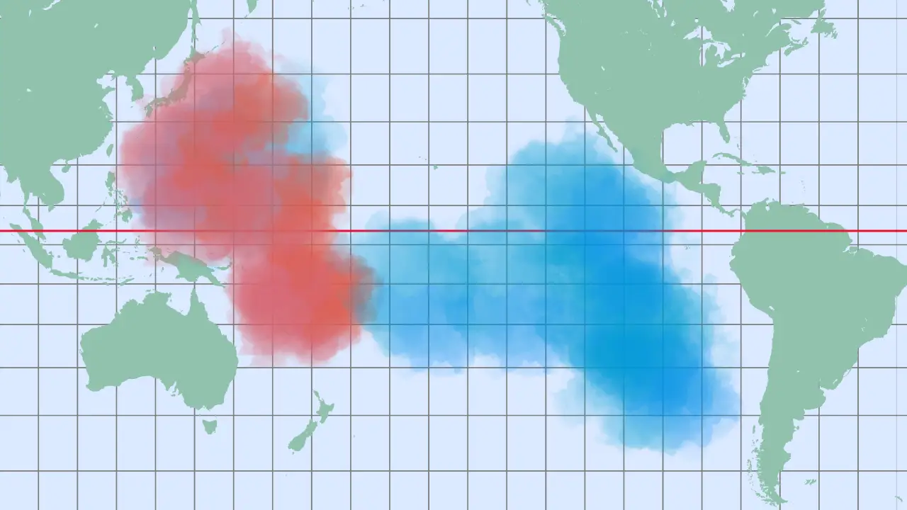
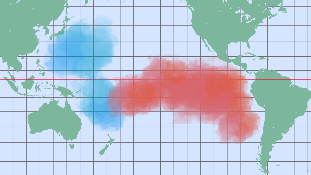
Under normal conditions, strong trade winds push warm surface waters westward. This allows cold, nutrient-rich water to rise near Peru and Ecuador. The process, called upwelling, supports marine life and stabilizes weather. During El Niño, however, those trade winds weaken or even reverse. Warm surface water then flows eastward across the Pacific. As a result, it builds up in the central and eastern Pacific and raises sea temperatures by several degrees.

This shift disrupts more than just the oceans. Upwelling stops, which starves fisheries and marine ecosystems. In addition, warmer water heats the air above it. That change alters rainfall, causing storms in normally dry regions and droughts in places that usually receive heavy rain.


Global Impacts of El Niño

El Niño’s effects extend far beyond the Pacific. In fact, they create a chain reaction that touches nearly every region on Earth.


Asia and Australia

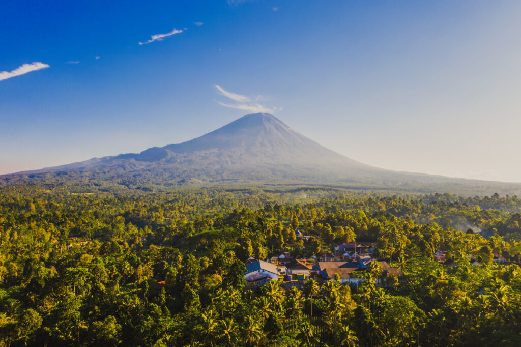
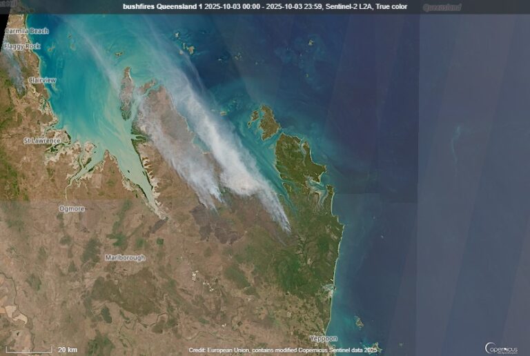
In Asia and Australia, El Niño often triggers drought. Rivers shrink, farmland dries out, and wildfires become more intense. For example, Indonesia experienced catastrophic forest fires in both 1997 and 2015, largely fueled by El Niño conditions.


South America

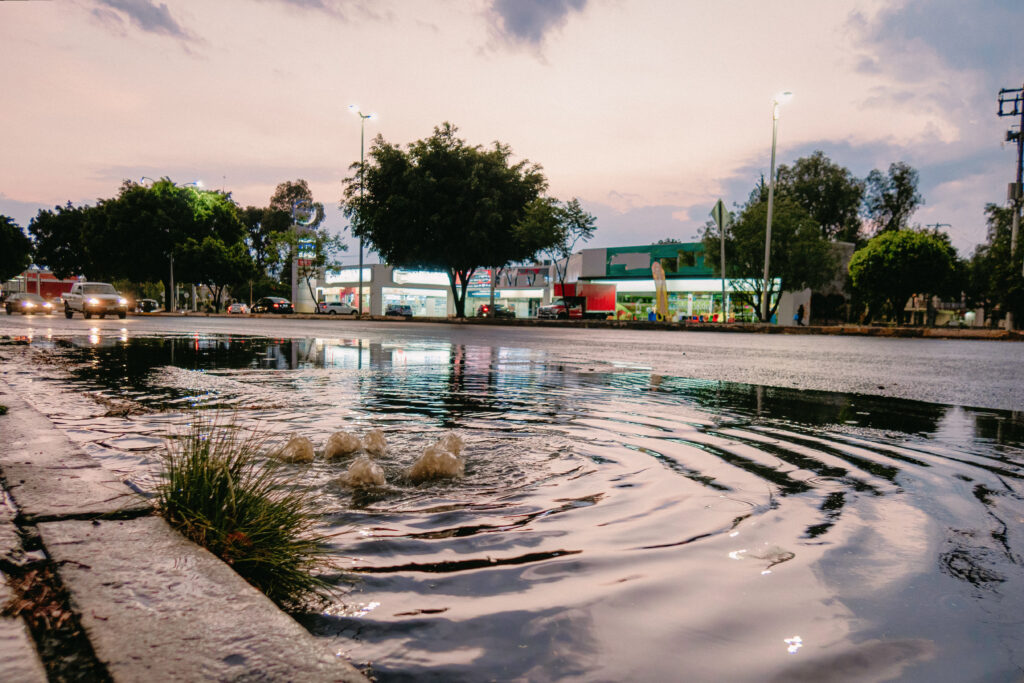
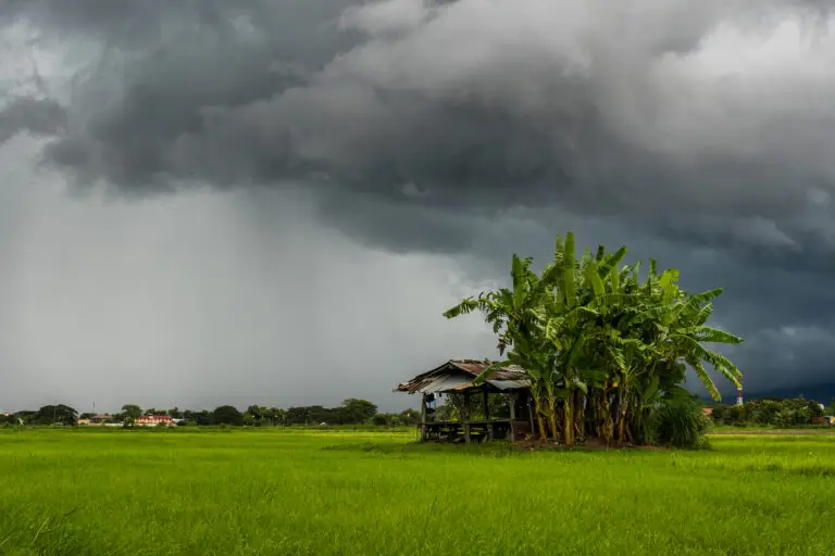
On the eastern side of the Pacific, the impact is the opposite. Peru and Ecuador, which are usually dry, suddenly experience heavy rainfall. As a result, storms trigger floods and mudslides that damage homes, farmland, and infrastructure.


Farther inland, northern Brazil and the Amazon often face drought. In contrast, southern Brazil, Argentina, and Uruguay usually receive excessive rainfall. Consequently, these countries deal with widespread flooding and economic losses.


Africa and the Oceans

El Niño also affects Africa. In eastern Africa, countries such as Kenya and Tanzania often experience heavy rains. Therefore, floods can spread disease and disrupt communities. However, southern Africa usually suffers from drought. Millions of people then risk food shortages and crop failure.

The oceans themselves change as well. Cold-water upwelling shuts down off South America, starving fish populations. Anchovy and sardine stocks collapse, which harms sea lions and seabirds. In addition, warm waters stress coral reefs. As a result, coral bleaching occurs in fragile ecosystems such as the Great Barrier Reef.


El Niño and the United States

The United States also experiences major impacts from El Niño, especially in winter. The Pacific jet stream shifts southward, redirecting storms into new areas.


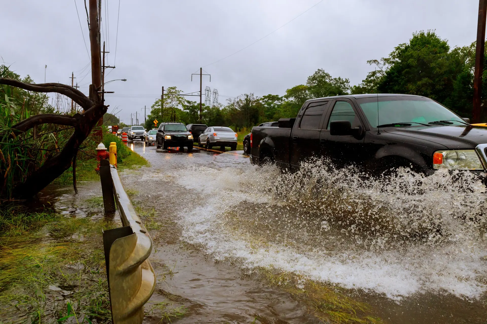
California often receives heavy rainfall. Strong El Niño years such as 1997–98 and 2015–16 brought record floods and mudslides. In addition, Texas, Louisiana, and Florida tend to face wetter winters with more frequent storms.


In contrast, the Pacific Northwest usually becomes warmer and drier. This leads to reduced snowpack and threatens water supplies. The Midwest shows more variation. Some years bring welcome rain, while others cause damaging frost. Therefore, El Niño keeps farmers uncertain about their harvests.

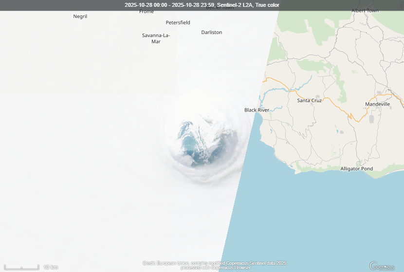
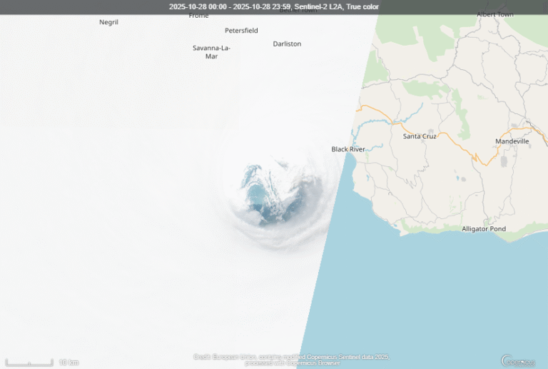
El Niño also influences hurricanes. In the Atlantic, stronger upper winds suppress hurricane formation. As a result, the East Coast and Gulf of Mexico often see fewer and weaker hurricanes. However, the opposite happens in the Pacific. There, El Niño fuels more tropical storms, some of which bring late-season rain into the U.S. Southwest.


How Scientists Predict El Niño

Modern science makes it possible to forecast El Niño months ahead. Scientists use anchored buoys across the Pacific that measure temperatures, currents, and winds. Satellites add more data about clouds and rainfall.

When warm water appears in the central and eastern Pacific, researchers pay close attention. If trade winds weaken and storms shift eastward, the signs become clear. As a result, computer models can simulate how El Niño will develop. Agencies such as NOAA in the United States, BoM in Australia, and ECMWF in Europe run these forecasts regularly.

However, predicting El Niño is not easy. The so-called “spring barrier” makes forecasts in March and April less reliable. Small ocean changes can alter the outcome. Even so, improved technology now allows warnings three to six months in advance. Consequently, governments, farmers, and disaster planners have more time to prepare.


El Niño in a Warming World

Scientists increasingly ask whether climate change is making El Niño worse. Evidence suggests that it is.

Warmer oceans provide more fuel for El Niño. Strong events are becoming more intense, and their effects are amplified by higher global temperatures. For example, the 2015–16 El Niño helped make 2016 the hottest year ever recorded at the time. Coral reefs bleached, crops failed, and over 60 million people were affected worldwide.

In addition, even La Niña years, which normally cool the planet, now rank among the warmest years recorded. This shows how climate change raises the baseline for all events. Therefore, the next strong El Niño may again set new global heat records.


So, El Niño is not just a weather event. It is a global climate driver that affects rainfall, temperature, ecosystems, and economies.


In a warming world, its effects may grow even stronger. However, thanks to better monitoring and prediction, societies now have tools to prepare. Therefore, studying El Niño is essential for protecting lives, securing food supplies, and reducing damage.

Understanding El Niño is a key step in adapting to climate change.


Question you can anwser now: 

  • What is El Niño?
  • How does El Niño form in the Pacific Ocean?
  • How does El Niño impact Asia, South America, and Africa?
  • How does El Niño affect marine life and oceans?
  • How does El Niño change weather in the United States?
  • How does El Niño affect hurricanes in the Atlantic and Pacific?
  • How do scientists detect and predict El Niño?

Read more...

The History of the North Atlantic Ocean

Thousands of miles of emptiness. Nothing but blue, grey, green and white. Giant waves, shrieking gales, water so cold. This is what millions of people in history had to cross in order to begin new...

Deep Oceans – Abyssal Plains, Trenches and their Bizarre Life

Oceanography – the nature of the vast oceans and their ecosystems. The largest of the world’s biomes is the one we know the least of. Crushing pressures and the vast extent of the abyssal...

Shallow Seas – Continental Shelf, Coral, Plankton and Kelp

Coral Reefs, seaweed, kelp and plankton. Just a handful of lifeforms that we find in waters where light can reach, where plankton can photosynthesise, and for a complex array of plants and animals to...

The Vikings: Ruthless Conquerors or Pioneering Explorers?

The Vikings: Ruthless Conquerors or Pioneering Explorers?

The Viking Age was more than a saga of bloodshed and conquest—it was a transformative period that reshaped Europe, fostered new trade routes, and sparked the first transatlantic voyages. Stretching from the late 8th century to the early 12th, this era saw Norse seafarers from Scandinavia expand their reach from icy fjords to sunlit monasteries, and from local farmsteads to the shores of North America. Often misunderstood as ruthless barbarians, the Vikings were also skilled navigators, resourceful settlers, and vibrant cultural agents. Their story is not only about what they destroyed—but what they built, explored, and ultimately, how they shaped our modern world.


Climate and Habitat

Scandinavia during the early Middle Ages presented a landscape as unforgiving as it was breathtaking. Towering mountains, thick forests, and narrow fjords, especially prominent in Norway and northern Sweden, defined the physical environment. This rugged terrain made large-scale agriculture difficult, so Viking communities adapted to a seasonal rhythm. During the brief yet vital summers, Norse farmers planted barley and rye, tended livestock, and preserved food for the harsh winters by drying fish and salting meat.

Crucially, this period overlapped with the Medieval Warm Period, a climatic phase from around 900 to 1300 AD marked by slightly warmer average temperatures across northern Europe. This modest warming extended the boundaries of agriculture, enabling Norse settlers to farm in more marginal areas like Iceland and Greenland. It was a turning point that facilitated the Viking westward expansion. However, by the 13th century, a cooling trend emerged—the Little Ice Age. Winters grew longer, sea ice blocked trade routes, and farming became more precarious. These climate shifts played a subtle but significant role in both the rise and eventual decline of Viking settlements abroad.


Shipbuilding and Navigation

If the Scandinavian environment shaped the resilience of the Vikings, it was their ships that carried them across the known and unknown world. Central to Viking dominance was the longship—an engineering marvel that was both swift and maneuverable. Using clinker-building methods, shipwrights overlapped planks of wood along the hull and secured them with iron rivets, creating a structure that was simultaneously strong and flexible. This allowed the ships to handle rough seas while navigating shallow rivers and beaching on almost any shore.

With a square woolen sail and rows of oars manned by warriors, longships could reach speeds up to 15 knots. Their shallow drafts enabled beach landings and quick getaways, perfect for raids and explorations. Yet, Vikings also built broader cargo vessels called knarrs. These ships were the logistical backbone of Norse expansion, transporting goods, animals, and people between distant colonies. Their ability to travel vast distances without advanced navigation instruments is a testament to Viking ingenuity. Instead, they used the stars, sun, currents, and possibly even sunstones—polarizing crystals—to guide their voyages.


Viking Expansion Across Europe

From the late 8th to 11th centuries, the Vikings expanded across Europe in independent warbands seeking prestige and silver. In England and Scotland, their incursions began with lightning raids on coastal monasteries and towns, but by 865 AD, the dynamic shifted dramatically with the arrival of the Great Heathen Army. This force aimed not only to plunder but also to conquer and settle, eventually establishing control over large swathes of northern and eastern England, an area known as the Danelaw. Even as Anglo-Saxon leaders like Alfred the Great fought to reclaim their territories, the Viking influence remained embedded in the land and governance. The climax came in 1016 when Danish King Cnut the Great ascended to the English throne, creating a North Sea empire that tied together England and Scandinavia through shared rule and commerce.

H3: Viking Settlements in Ireland and Normandy

In Ireland, Viking warriors initially clashed with local populations but gradually transitioned from raiders to settlers. In 841, they founded Dublin, which started as a fortified encampment and evolved into a key trading city. Over time, Norse settlers established other significant towns like Galway, Cork, and Waterford. The interactions between Norse and native Irish, though initially violent, gradually evolved into a cultural blending characterized by intermarriage, shared trade networks, and mutual influence.

On the continent, across the Channel in what is now France, the Vikings pushed inland via the Seine River. One of their most notable conquests was the sack of Paris in 845. The Frankish response was strategic rather than confrontational; King Charles the Simple granted land to Viking leader Rollo, who founded Normandy, a duchy whose name literally means “land of the Northmen.” Normandy would later play a pivotal role in European history, including the Norman Conquest of England in 1066.

H3: Viking Influence in Eastern Europe and the Rus

In Eastern Europe, a different narrative unfolded. Swedish Vikings, known as Varangians, sailed across the Baltic Sea and navigated the complex river systems of what is now Russia and Ukraine. They founded key settlements like Ladoga and Novgorod, eventually giving rise to the powerful state of Kievan Rus. These Norse settlers controlled important trade routes along the Dnieper and Volga rivers, reaching as far as the Byzantine Empire and the Islamic Caliphate. Goods such as furs, honey, amber, and slaves flowed through their hands. Some of these Viking warriors entered the service of the Byzantine Emperor as part of the elite Varangian Guard, known for their loyalty and fearsome combat skills.


Norse Colonies in Iceland, Greenland, and Vinland

Viking ambitions extended far beyond Europe. In the late 9th century, Norse seafarers sailed westward into the uncharted waters of the North Atlantic. Around 874, a Norwegian chieftain named Ingólfur Arnarson arrived on the rocky coasts of a mist-covered island and established the first permanent Norse settlement in what would become Reykjavík, Iceland. The name itself—meaning “smoky bay”—reflected the island’s geothermal activity. Iceland, then sparsely populated by a few Irish monks, rapidly became a new frontier for Viking culture and society.

Soon after, Erik the Red, a figure both infamous and visionary, was exiled from Iceland for manslaughter. Rather than disappear into obscurity, he sailed even farther west and discovered a vast and icy new land. To entice settlers, he called it Greenland, despite its harsh terrain and colder climate. This clever marketing worked, and in 986 he led a fleet to establish two principal colonies—the Eastern and Western Settlements. For a time, aided by the warmth of the Gulf Stream and the Medieval Warm Period, these communities thrived.

H3: Leif Erikson and the Norse in North America

The Norse didn’t stop at Greenland. Around the year 1000, Erik’s son, Leif Erikson, journeyed even further west. He landed in a region he called Vinland, believed to be located in present-day Newfoundland, Canada. Unlike Greenland, Vinland featured forests, fresh water, and wild grapes—leading to its evocative name. Modern archaeology, particularly the discovery of a Norse settlement at L’Anse aux Meadows, confirms the reality of these voyages. However, the Norse presence in North America was brief. Conflicts with Indigenous populations, long supply lines, and severe winters led to the eventual abandonment of these outposts.

Viking Heartlands: Uppsala, Birka, and Hedeby

While Viking expeditions spread across the globe, the heart of their civilization remained rooted in Scandinavia, where centers of trade, governance, and religion flourished. In Sweden, the ancient site of Gamla Uppsala emerged as a key religious and political hub. According to historical texts like those of Adam of Bremen, it featured a grand temple dedicated to Norse deities such as Odin, Thor, and Freyr. Every nine years, significant sacrifices—sometimes human—were held to ensure peace, prosperity, and divine favor. Monumental burial mounds in the area underscore its importance as both a cultural and spiritual capital.

H3: Birka—Sweden’s First Urban Trading Post

Another major center was Birka, founded on the island of Björkö in Lake Mälaren near present-day Stockholm. Often described as Sweden’s first true urban settlement, Birka became a vibrant hub of trade linking Scandinavia to the wider world, including Eastern Europe and even the Middle East. Goods like furs, iron tools, amber, and textiles passed through its markets, drawing merchants from diverse backgrounds. In 829, the town welcomed Christian missionary Ansgar, marking one of the earliest attempts to introduce Christianity into Viking society.

H3: Hedeby—Denmark’s Commercial Powerhouse

Meanwhile, in Denmark, the town of Hedeby stood at a geographical and commercial crossroads. Situated near the base of the Jutland Peninsula, it connected the North Sea and Baltic via a short overland route. This strategic position made it Denmark’s most vital trading center for centuries. Hedeby boasted skilled shipbuilders, blacksmiths, and coin makers. Artifacts unearthed there suggest bustling markets with goods arriving from as far as the Islamic Caliphate. Despite its prosperity, Hedeby was eventually attacked and destroyed, likely due to its wealth and strategic importance.


Daily Life, Social Order, and Religion

Despite their fierce reputation, most Vikings were not warriors but farmers, fishermen, and craftsmen. Their daily lives revolved around the land and sea. Longhouses, constructed from timber or turf, served as homes for extended families and were the centers of domestic activity. Meals included porridge, salted fish, meat, dairy, and bread, while woolen clothing and iron tools were crafted locally.

Viking society was stratified into jarls (nobility), karls (free people), and thralls (enslaved laborers). Governance occurred in assemblies called things, where laws were made and disputes settled—a democratic feature rare for its time. Iceland’s Althing, founded in 930 AD, is one of the oldest known parliaments.

Their religion was rich with deities like Odin, Thor, and Freyr, who embodied wisdom, war, and fertility. Worship was communal, often involving sacrifices for good harvests or protection. Norse mythology, preserved through sagas and eddas, reflects their worldview—a blend of heroism, nature reverence, and fatalism. Women held a respected status, managing farms, owning property, and sometimes wielding political power. Runestones and burial sites reveal that even in death, Vikings honored their social order and spiritual beliefs.


Lasting Legacy of the Vikings

Although the Viking longships have vanished from Europe’s coasts, their legacy remains deeply embedded in modern culture and society. Linguistically, Old Norse influenced many modern languages—particularly English. Everyday words like “sky,” “egg,” “window,” and “law” have Norse origins, and place names across Britain and Ireland still bear Norse suffixes like -by, -thorpe, and -wick.

Thousands of runestones across Scandinavia stand as lasting monuments to Viking stories, voyages, and losses. These granite markers—often adorned with runes—commemorate family members, express religious beliefs, and serve as records of migration and conquest. Some are Christian, some pagan, and many blend both, highlighting a transitional era.

Modern genetic studies confirm what history suggests: Norse ancestry is widespread across the British Isles, coastal France, and parts of Russia and Ukraine. Vikings left not only cultural but also biological imprints on the peoples they encountered. Their mythology thrives in books, film, and popular culture, while museums and archaeological sites across Scandinavia, Britain, and Canada continue to reveal new insights into this dynamic civilization.

Frequently Asked Questions About the Viking Age

Q1: When did the Viking Age begin and end?
The Viking Age traditionally spans from the raid on Lindisfarne in 793 AD to around the early 12th century, when Scandinavian kingdoms consolidated and raiding ceased.

Q2: Did Vikings really wear horned helmets?
No. The popular image of horned helmets is a myth. Archaeological evidence shows that Viking helmets were typically conical, made of iron or leather, and lacked horns.

Q3: How did Vikings navigate without compasses?
Vikings relied on the sun, stars, wind patterns, sea currents, and tools like sunstones to navigate. They had an intimate understanding of the sea and coasts.

Q4: Where did Vikings settle outside of Scandinavia?
Vikings established settlements in England, Ireland, France (Normandy), Iceland, Greenland, and briefly in North America (Vinland, now part of Canada).

Q5: What was daily life like for a Viking?
Most Vikings were farmers who lived in extended families. They grew crops, fished, raised livestock, and crafted tools. Social life revolved around seasonal work and gatherings at assemblies (things).

Q6: What modern influences can be traced back to Vikings?
Their legacy lives on in language (many English words have Norse origins), place names, democratic practices, genetic ancestry, and popular culture including mythology and literature.


Conclusion: The Enduring Echoes of the Viking Age

The Viking Age was not just an episode of medieval violence—it was a period of intense cultural, environmental, and political change. From their innovative ships and strategic warfare to the societies they built and the myths they left behind, the Vikings shaped history far beyond their fjords. They forged trade networks, founded new cities, experimented with democratic principles, and tested the boundaries of the known world.

Though their raids eventually gave way to state-building and Christian conversion, the Viking spirit of exploration and adaptation lives on. Their story is a vivid reminder that history is often more complex than legend—and that those we remember as conquerors were also creators, innovators, and connectors of civilizations.


Read more...

What we now know about Hurricane Melissa

Hurricane Melissa, one of the strongest Atlantic storms ever recorded, has devastated Jamaica before moving toward Cuba and the Bahamas...

Iceland’s First Mosquitoes: Will They Survive?

For the first time in history, wild mosquitoes have been discovered in Iceland — a place long known as one of the few mosquito-free countries on Earth. The finding has surprised scientists and sparked...

How does La Niña affect the world in 2025?

La Niña is back! But what exactly is La Niña? Around the globe, climate patterns swing between two powerful forces: El Niño and La Niña. These events influence weather everywhere — from devastating...

Two Strong Earthquakes Strike on the Same Day

Two strong earthquakes struck on October 16, 2025 — a M6.3 in the Drake Passage and a M6.5 near Papua, Indonesia. No tsunami warnings were issued...

Heavy Rains in Mexico, Leaving Nearly 130 Dead or Missing

Heavy rains flood Mexican towns, leaving nearly 130 dead or missing MEXICO CITY — October 15, 2025. A tropical depression unleashed torrential rains across parts of Mexico’s Gulf Coast and central...

Queensland bushfire warning issued after unusually hot weather

Record-breaking October heat has sparked dozens of Queensland bushfires, forcing evacuations and testing firefighters early in the season. Authorities say the early fires fit forecasts for a...

Why monsoon rains have been so unusual heavy this year

The 2025 monsoon is shifting from southwest to northeast after one of the wettest seasons in years. Discover why it was so intense and what comes next...

Satellites in Disaster Recovery: Role in Flood and Change Detection

When floods or other natural disasters occur, every minute matters. Today, rescue teams have eyes from above, using satellite imagery, drones, or helicopters. As a result, they get a clear picture of...

El Niño: A Complete Guide to Causes and Global Impacts

El Niño causes and effects explained. This climate event starts in the Pacific Ocean but impacts global weather, from floods in South America to drought in Africa. Learn how it forms, why it matters...

The City of Baarle

10 Surprising Revelations About the City of Baarle:
A Border Enclave Marvel

Nestled on the Belgian–Dutch frontier lies Baarle, a town famous for its astonishing patchwork of sovereignty. Instead of a straight border, this municipality comprises 22 Belgian enclaves embedded within Dutch soil—and, within those, seven Dutch counter-enclaves belonging to Baarle-Nassau. Imagine brewing coffee in Belgium and stepping just a few feet to drink it in the Netherlands—all while never leaving the same house.


Everyday services in Baarle follow their own logic. Mail toggles between PostNL and bpost depending on which side of your hallway your letterbox sits. Utility meters, emergency numbers, school districts, even tax rates change mid-room. Businesses exploit these quirks: cafés place their main door in whichever country offers the lower VAT rate, while pubs choose the side with more relaxed licensing laws.


Despite the complexity, life here hums along smoothly. Two mayors, two police forces, and joint municipal councils coordinate everything from trash collection to festival permits. Visitors are drawn not by grand monuments, but by the thrill of crossing an international boundary—sometimes dozens of times—on a single stroll through town.


Historical Origins of Baarle’s Enclaves

Medieval Treaties and Feudal Legacies

The roots of Baarle’s labyrinth date to 1198, when feudal lords swapped tiny parcels of land as political bargaining chips. The Dukes of Brabant and the Lords of Breda recorded each exchange as a separate deed—without ever consolidating them into a single territory. Over generations, these individual agreements multiplied into the 22 Belgian enclaves and their nested Dutch pockets we see today.


Local peasants in the late Middle Ages might farm fields under one lord’s jurisdiction and sleep in a village overseen by another. Boundaries hugged property lines rather than geographic features, giving rise to convoluted borders that never changed, even as larger states formed. When larger powers absorbed the region, they inherited the medieval patchwork instead of redrawing it.


Evolution through the Napoleonic Wars

Napoleon’s administrators, keen to simplify Europe’s borders, re-surveyed vast territories—but Baarle’s micro-plots proved too small to reassign easily. After the Congress of Vienna in 1815 and Belgian independence in 1830, the enclaves were formally recognized in international treaties. The Treaty of Maastricht of 1843 clarified many boundaries, yet left the mosaic intact. Subsequent wars and political shifts only reinforced the status quo: neither Belgium nor the Netherlands saw sufficient benefit in re-parceling land that local communities already understood how to manage.


Geography and the Border Complexity

Belgian Enclaves Inside the Netherlands

The 22 Belgian exclaves of Baarle-Hertog vary dramatically in size—from multi-acre farms to a handful of houses—but all are legally Belgian territory. To reach them, one often walks along Dutch roads, crosses private driveways, or hops a painted line inside someone’s living room. Each enclave flies the Belgian flag and follows Belgian laws, yet is entirely encircled by the Dutch municipality of Baarle-Nassau.


Most boundaries trace medieval property deeds rather than natural features. That means an enclave can snake through backyards, follow hedgerows, or bisect residential streets. Municipal services—road repairs, snow plowing, waste collection—are funded and managed by Belgian authorities, even though the trucks may drive over Dutch pavement to reach them.


Dutch Enclaves Within Belgian Enclaves

Even more bewildering are the seven tiny Dutch counter-enclaves inside those Belgian parcels. Known administratively as part of Baarle-Nassau, these “islands” of the Netherlands are accessible only by crossing Belgian land. Residents here register with Dutch authorities for voting, taxation, and schooling, yet frequently rely on Belgian utilities by virtue of proximity and existing infrastructure.


Binational agreements spell out which ambulance service responds first, how firefighting costs are shared, and who maintains streetlights. During local festivals, Dutch and Belgian event planners collaborate on permits, security, and emergency access—even though the venue might lie in two countries at once.


Everyday Life on a Border Street

Split Houses and Dual Doors

In Baarle, dozens of homes are literally cut in two by the national border. Homeowners install two front doors—one Belgian, one Dutch—so they can choose which jurisdiction to “enter” each day. This choice affects everything: which school the kids attend, where taxes are paid, and under which health system residents receive care.


Inside, separate utility meters are common. Families may receive two electricity bills—from a Belgian provider for the parts of the home in Belgium, and from a Dutch supplier elsewhere. Mail sorting depends on which room your mailbox sits in: postal workers from PostNL or bpost drop letters off accordingly. In an emergency, stepping half a room can decide whether you dial a Belgian or Dutch dispatcher.


Border Markers in Homes and Businesses

Metal studs set into the pavement and painted lines across thresholds mark the exact border. You’ll spot them across café floors, restaurant patios, and even private staircases. Business owners place counters, doors, and signage carefully to capture the most advantageous regulations: a coffee shop might seat customers under Belgian VAT rules on one side of the line, then transition them into Dutch territory for alcohol licensing benefits.


Tourists delight in straddling the border line painted through shop entrances. Many cafés label menu sections “Belgian side” vs. “Dutch side,” with prices reflecting the different VAT rates. Local craftsmen create miniature models of split houses and souvenir maps that fold to reveal the enclave layout—reminders of how centuries-old treaties continue to shape daily life.


Legal and Administrative Oddities

Two Police Forces and Two Mayors

Baarle-Hertog and Baarle-Nassau each elect their own mayor and town council, and maintain separate police forces. Yet public safety cannot stop at painted lines, so regular “bilateral security meetings” align patrol schedules, traffic enforcement, and emergency protocols. If an incident spans the border—say, a stolen bike hidden in a Belgian enclave but ridden into the Netherlands—Belgian and Dutch officers collaborate on the investigation.


Infrastructure projects, like joint CCTV installations or streetlight upgrades, are funded on a pro-rata basis determined by enclave size and population. Similarly, firefighting and medical services use pre-agreed cost-sharing formulas so that the nearest available crew responds, regardless of nationality.


Tax, Alcohol, and Tobacco Strategies

Local entrepreneurs exploit divergent regulations. Cafés often place their main entrance in Belgium to benefit from a lower VAT rate on food and drink, while pubs orient doors toward the Netherlands for longer opening hours and looser alcohol licensing. Tobacco shops position their checkout counters on Dutch soil—where excise duties are lower—while storing most stock in Belgian backrooms.


Tourists frequently cross the border to stock up on cigarettes or spirits at lower duty rates, then step back across the line to re-enter the other country. Authorities conduct joint audits to ensure businesses comply with both excise and VAT regulations, balancing free movement with fair taxation.


Citizenship: Where’s Your Front Door?

Nationality by Address

In most places, birthplace and parentage determine nationality. In Baarle, your “official” country also depends on which front door you register with municipal authorities. Registering under the Belgian door means voting in Belgian elections, paying Belgian income tax, and sending children to Belgian schools—even if the majority of your property is on Dutch soil.


Historical Door-Moves for Citizenship

In the early 20th century, some resourceful homeowners simply rebuilt or relocated their front door a few meters to switch national affiliation. They petitioned Belgian and Dutch surveyors, redrew property maps, and literally moved entrance frames to flip their nationality. Modern regulations now make such maneuvers nearly impossible, but the legends live on as proof of the town’s unique relationship with sovereignty.


Tourism: What to See and Do

Walking the Border Trail

The self-guided Border Trail winds through the town center, following painted lines and embedded studs. Bilingual plaques explain each enclave’s origins, from medieval deeds to Napoleonic treaties. For a deeper dive, local guides offer tours that recount colorful anecdotes—like how a café owner once held two drinking licenses for the same establishment by straddling the border with his bar counter.


Must-Visit Cafés and Borderline Shops

At Café de Grens, pastries served on the Belgian side incur a 6% VAT, while those just a meter away on Dutch territory carry 9%. The Borderline Bookshop uniquely splits its shelves—Belgian titles on one side, Dutch works on the other—with separate price tags reflecting each country’s pricing. Souvenir shops sell miniature split-floor models, dual-fold maps, and enamel pins shaped like the enclave mosaic.


Impact of COVID-19 on the City of Baarle

When the pandemic struck, Belgium imposed stricter closures than the Netherlands. One side shuttered non-essential retail and indoor dining, while just a few doors down, the other side remained open. Residents formed neighborhood WhatsApp groups to track daily rule changes by enclave. Dual-mayor councils convened emergency sessions to align testing centers, harmonize public health messaging, and distribute supplies—showcasing how cross-border cooperation can save lives when national policies diverge.


Future Prospects and Border Innovations

Digital Border Monitoring

Municipal planners are developing an augmented-reality app that overlays historical deeds and treaty texts onto smartphone cameras. As users walk the Border Trail, pop-up windows will highlight original 1198 deed scans, Napoleonic survey maps, and modern zoning regulations—turning each step into an interactive history lesson.


Sustainable Cross-Border Projects

Shared solar-panel arrays now ring enclave perimeters, feeding renewable electricity into both Belgian and Dutch grids. Dual-plug electric-vehicle charging stations bear both country’s connectors. Looking ahead, flexible zoning reforms aim to smooth regulations for renovations spanning the border, encouraging unified, eco-friendly design rather than duplicated permits.


Frequently Asked Questions

  1. How many enclaves does Baarle have?
    Baarle comprises 22 Belgian enclaves (Baarle-Hertog) inside the Netherlands and seven Dutch counter-enclaves (Baarle-Nassau) nested within those Belgian parcels.

  2. Can you cross the border anywhere?
    Yes. There are no checkpoints—only metal studs and painted lines mark the border through streets, homes, and businesses.

  3. Who holds more power: the Belgian or Dutch mayor?
    Both mayors have equal authority within their jurisdictions. They meet regularly to coordinate shared services and policies.

  4. Do residents pay taxes in both countries?
    Homeowners pay income tax only in the country of their registered front door. Businesses, however, may incur duties or VAT obligations in both, depending on their layout and operations.

  5. Were there ever disputes over the enclaves?
    Minor disputes—mainly over utility billing and emergency response—have arisen. Major boundary questions were settled by 19th-century treaties and have remained stable since.

  6. Is the border upheld by international law?
    Yes. The enclaves are recognized by bilateral Belgian-Dutch treaties and benefit from EU and Schengen principles of free movement.


Conclusion

The city of Baarle stands as a living cartographic marvel, where medieval land swaps still govern modern life. Its weave of enclaves and counter-enclaves offers a masterclass in international cooperation, legal creativity, and community spirit. Whether you sip coffee on Belgian pavement or dance in a Dutch café, Baarle invites you to cross borders—without ever leaving town.

Read more...

What we now know about Hurricane Melissa

Hurricane Melissa, one of the strongest Atlantic storms ever recorded, has devastated Jamaica before moving toward Cuba and the Bahamas...

Iceland’s First Mosquitoes: Will They Survive?

For the first time in history, wild mosquitoes have been discovered in Iceland — a place long known as one of the few mosquito-free countries on Earth. The finding has surprised scientists and sparked...

How does La Niña affect the world in 2025?

La Niña is back! But what exactly is La Niña? Around the globe, climate patterns swing between two powerful forces: El Niño and La Niña. These events influence weather everywhere — from devastating...

Two Strong Earthquakes Strike on the Same Day

Two strong earthquakes struck on October 16, 2025 — a M6.3 in the Drake Passage and a M6.5 near Papua, Indonesia. No tsunami warnings were issued...

Heavy Rains in Mexico, Leaving Nearly 130 Dead or Missing

Heavy rains flood Mexican towns, leaving nearly 130 dead or missing MEXICO CITY — October 15, 2025. A tropical depression unleashed torrential rains across parts of Mexico’s Gulf Coast and central...

Queensland bushfire warning issued after unusually hot weather

Record-breaking October heat has sparked dozens of Queensland bushfires, forcing evacuations and testing firefighters early in the season. Authorities say the early fires fit forecasts for a...

Why monsoon rains have been so unusual heavy this year

The 2025 monsoon is shifting from southwest to northeast after one of the wettest seasons in years. Discover why it was so intense and what comes next...

Satellites in Disaster Recovery: Role in Flood and Change Detection

When floods or other natural disasters occur, every minute matters. Today, rescue teams have eyes from above, using satellite imagery, drones, or helicopters. As a result, they get a clear picture of...

El Niño: A Complete Guide to Causes and Global Impacts

El Niño causes and effects explained. This climate event starts in the Pacific Ocean but impacts global weather, from floods in South America to drought in Africa. Learn how it forms, why it matters...