The Amazon Rainforest: History, Biodiversity & What Lies Ahead

The Amazon Rainforest:
Its Past, Present, and Future

The Amazon Rainforest. Raw, wild and absolutely essential to life as we know it. It is one of the most awe-inspiring and ecologically vital regions on the planet. Spanning over nine countries in South America and covering more than 5.5 million square kilometers, it houses unparalleled biodiversity and serves as a lifeline for Earth’s climate. Yet, behind its verdant canopy and teeming rivers lie stories of ancient civilizations, urgent environmental threats, and remarkable resilience.


In this comprehensive guide, we delve into the untold wonders, historical roots, cultural richness, and the alarming challenges facing the Amazon today. From its sprawling river systems and endangered wildlife to the critical role indigenous people play in conservation, this article offers a deep dive into why protecting the Amazon Rainforest isn’t just a regional issue—it’s a global imperative.


Size and Location of the Amazon Rainforest

The Amazon Rainforest is an ecological giant, stretching over 5.5 million square kilometers (2.1 million square miles) and making up over half of the planet’s remaining tropical forests. It is primarily located in South America, spanning nine countries: Brazil, Peru, Colombia, Venezuela, Ecuador, Bolivia, Guyana, Suriname, and French Guiana. Brazil accounts for the largest portion—about 60% of the total forest area—followed by Peru and Colombia. The forest basin is bordered by the Andes Mountains to the west, which play a vital role in shaping its rainfall and river systems.

This immense green expanse is not just a forest but an interconnected network of ecosystems ranging from dense canopy forests and swampy floodplains to seasonal savannas and mountainous rainforests. Its scale is staggering; the Amazon is larger than the entire European Union or nearly equivalent to the contiguous United States. According to NASA, the forest plays a critical role in Earth’s hydrological cycle, generating 20% of the world’s freshwater runoff into oceans (NASA Earth Observatory). The rainforest’s vastness ensures it significantly influences global weather, climate, and biodiversity.


The Origin and History of the Amazon Rainforest

The Amazon Rainforest is estimated to have formed around 55 million years ago, during the Eocene epoch, following the separation of the South American and African tectonic plates. It developed as a tropical forest after the Andean uplift reconfigured the region’s topography and river systems, transforming what was once a giant inland sea into today’s Amazon Basin. This ancient evolution gave rise to one of the most complex and species-rich ecosystems on the planet.


While the ecological story is fascinating, the human history of the Amazon is equally compelling. Contrary to the outdated myth of an untouched wilderness, research has shown that indigenous civilizations have lived in and shaped the Amazon for at least 11,000 years. Archaeological evidence, including complex mound structures, road networks, and terra preta (man-made fertile soil), points to advanced pre-Columbian societies. These early inhabitants used sophisticated agricultural techniques, cultivating crops like cassava and maize while managing forest resources sustainably (Smithsonian Magazine).


Indigenous Peoples of the Amazon Rainforest

The Amazon is home to an incredibly diverse population of over 400 indigenous tribes, many of whom have lived in the forest for millennia. It’s estimated that about 1 million indigenous people inhabit the region, speaking over 300 distinct languages and maintaining vibrant cultural traditions. Notable tribes include the Yanomami, Kayapo, Ticuna, Asháninka, and Huitoto, each with unique cosmologies, rituals, and ecological knowledge deeply rooted in the rainforest.


These communities depend on the forest for food, medicine, and spiritual well-being. They practice sustainable hunting, fishing, and slash-and-burn agriculture (when done traditionally and cyclically) that enhances biodiversity rather than diminishes it. Indigenous stewardship has proven to be one of the most effective strategies for preserving the rainforest’s ecological integrity. A study published in PNAS (2021) found that deforestation rates were significantly lower in indigenous territories compared to other protected areas (PNAS Journal).


Modern-Day Challenges for Indigenous Communities

Despite their proven role in conservation, indigenous communities face significant threats from encroachment, resource exploitation, and political marginalization. Deforestation for logging, cattle ranching, and agriculture often occurs illegally on their lands. Moreover, illegal mining operations bring mercury pollution, violence, and disease. Governments have made efforts to secure land titles and implement protective legislation, but enforcement is inconsistent. Organizations like Survival International and the Amazon Watch are actively working to advocate for indigenous rights and increase global awareness.


The Amazon River: Lifeline of the Rainforest

Flowing for approximately 6,400 kilometers (3,980 miles), the Amazon River is the second-longest river in the world after the Nile, but it easily surpasses all others in water volume. It discharges an astonishing 209,000 cubic meters per second into the Atlantic Ocean—about 20% of all freshwater entering the world’s oceans. Originating from the Andes Mountains in Peru, the river meanders through dense forests and lowland plains, finally emptying into a massive delta in northern Brazil.


The river is the beating heart of the Amazon ecosystem, nourishing vast stretches of rainforest and supporting a remarkable variety of life. It sustains over 3,000 fish species, including the arapaimas, piranhas, and the endangered pink river dolphins. Seasonal flooding enriches the soil and creates unique aquatic habitats like the várzea (whitewater floodplains) and igapó (blackwater floodplains), crucial for biodiversity and nutrient cycling.


Major Tributaries and Navigability

The Amazon is fed by hundreds of tributaries, some of which—like the Madeira, Tapajós, and Negro Rivers—are massive rivers in their own right. These waterways form an extensive network of natural highways that are vital for local transportation and commerce. However, proposals for hydroelectric dams and infrastructure expansion pose serious threats to this delicate system, potentially altering the river’s flow, displacing communities, and affecting fish migration.


According to The Nature Conservancy, maintaining the Amazon River’s health is not only crucial for the ecosystem but also for the millions of people who rely on it for water, food, and transportation (The Nature Conservancy).


Biodiversity in the Amazon Rainforest

The Amazon Rainforest is the most biodiverse region on Earth. It is estimated to be home to 10% of the world’s known species, including over 40,000 plant species, 1,300 bird species, 430 mammals, 1,000 amphibians, and 3,000 types of fish. Every hectare of rainforest might contain hundreds of tree species, many still unknown to science. This remarkable biodiversity is due to the region’s warm climate, high rainfall, and complex web of microhabitats that foster evolution and niche specialization.


One of the most iconic species is the jaguar, the apex predator of the forest, whose stealth and strength help regulate the food chain. The forest is also home to vibrant macaws, curious capuchin monkeys, sloths, and the elusive harpy eagle. Below the forest canopy, the Amazon River and its tributaries teem with unique aquatic life, including the pink river dolphin, giant river otters, and piranhas.


Threatened and Endangered Species

Despite its richness, the Amazon is a battleground for many endangered species. The World Wildlife Fund (WWF) reports that habitat destruction and illegal wildlife trade are pushing species like the giant armadillo, golden lion tamarin, and the black caiman to the brink of extinction (source). Conservationists warn that we’re losing biodiversity faster than we can document it. Many organisms living in the Amazon may vanish before we even discover them, erasing opportunities for future medicines, ecological balance, and scientific knowledge.


Climate of the Amazon Rainforest

The Amazon’s climate is predominantly tropical and humid, with average annual temperatures ranging between 25°C and 28°C (77°F to 82°F). It receives over 2,000 millimeters (79 inches) of rainfall annually in most areas. This consistent moisture supports a year-round growing season and maintains the lush, green environment.

The rainforest plays a key role in its own weather patterns through evapotranspiration, where moisture is released from trees and contributes to cloud formation and rainfall. This process not only sustains local ecosystems but also affects weather systems as far as North America and Europe.


Effects of Climate Change

Recent studies published in Nature Climate Change and Science Advances reveal that the Amazon is experiencing longer dry seasons and more intense droughts, largely driven by global warming. These changes have made the forest more vulnerable to wildfires, which were once rare but are now becoming increasingly common due to a drier climate and deforestation-induced ignition points (NASA Earth Observatory). These fires threaten both biodiversity and the forest’s ability to function as a carbon sink.


Human Influence on the Amazon Rainforest

Human activity is one of the Amazon’s biggest threats. Over the past 50 years, nearly 17% of the rainforest has been lost, primarily due to deforestation for agriculture, cattle ranching, and infrastructure projects like roads and dams. Brazil, which holds the largest portion of the rainforest, has witnessed intense clearing, especially in the “arc of deforestation”, a zone stretching across the southern Amazon.


Industrial-scale soy farming and cattle grazing are leading causes of tree removal. Large multinational companies often incentivize the destruction of forest lands in pursuit of profit. This pattern not only disrupts ecosystems but also displaces indigenous peoples and fragments wildlife habitats.


Illegal Activities and Enforcement Issues

Illegal logging, gold mining, and poaching are widespread, often facilitated by corrupt officials or weak governance. A 2020 investigation by Mongabay, a respected environmental journalism site, highlighted how illegal gold mining operations contaminate rivers with mercury, threatening aquatic life and human health. Law enforcement faces significant challenges due to the forest’s vastness, remote terrain, and occasional violent resistance from criminal operations.


Impact of the Amazon Rainforest on the Global Climate

The Amazon plays an indispensable role in regulating the Earth’s climate. Its dense vegetation stores about 90-140 billion metric tons of carbon, helping to moderate global carbon dioxide levels and slow down climate change. The rainforest also influences rainfall patterns across continents. For instance, moisture from the Amazon contributes to precipitation in the Midwestern United States, impacting agriculture and water supplies.


The Rainforest’s Role as a Carbon Sink

Through photosynthesis, the Amazon acts as a carbon sink, absorbing more carbon than it emits. However, recent satellite data analyzed by NASA and the European Space Agency (ESA) show alarming trends: parts of the forest are now releasing more carbon than they store, primarily due to logging and burning (source). If this trend continues, the Amazon could reach a tipping point, beyond which it may no longer support the moisture cycle necessary to sustain itself—a scenario with profound global repercussions.


Protection and Recovery Efforts

Despite the dire threats, global efforts to protect the Amazon are underway. National governments, NGOs, indigenous communities, and international bodies are collaborating to enforce sustainable practices, conserve biodiversity, and restore degraded areas.


Initiatives like REDD+ (Reducing Emissions from Deforestation and Forest Degradation), led by the United Nations, offer financial incentives to countries and landowners for preserving forest cover. NGOs such as the Amazon Conservation Team and Rainforest Alliance work closely with indigenous communities to combine traditional ecological knowledge with modern conservation science.


Reforestation and Indigenous Stewardship

Reforestation efforts, including planting native trees and rehabilitating degraded land, are gaining momentum. However, scientists emphasize that protecting existing forest is far more effective than replanting new ones. Indigenous stewardship plays a pivotal role here. A 2021 study in PNAS (Proceedings of the National Academy of Sciences) found that forests managed by indigenous communities are significantly better preserved than those under government control or private ownership (source).


FAQs About the Amazon Rainforest

1. Why is the Amazon Rainforest called the “lungs of the Earth”?
Because it produces approximately 20% of the world’s oxygen and absorbs vast amounts of carbon dioxide, helping to regulate the global atmosphere.

2. What’s the biggest threat to the Amazon today?
Deforestation, primarily from agriculture and illegal activities, remains the most pressing issue.

3. Can the Amazon Rainforest recover if deforestation stops?
Yes, with time and proper reforestation practices. Natural regeneration can be effective, but active restoration helps speed up recovery.

4. How many indigenous tribes live in the Amazon?
Over 400 tribes live in the Amazon Basin, many with their own languages and cultural traditions.

5. How does the Amazon affect weather in the U.S.?
Moisture from the Amazon contributes to rainfall patterns that affect agriculture and weather in the United States and other regions.

6. What can individuals do to help protect the Amazon?
Support organizations focused on rainforest conservation, reduce consumption of products linked to deforestation (like soy and beef), and raise awareness.


Conclusion: Why the World Must Protect the Amazon Rainforest

The Amazon Rainforest is more than just a lush wilderness—it is a living, breathing system that supports millions of species, indigenous cultures, and the stability of our global climate. Its fate is tied to our own. Continued destruction of this vital biome would mean the loss of irreplaceable biodiversity, the collapse of key weather systems, and an acceleration of climate change.


However, hope remains. With stronger international cooperation, indigenous leadership, and a collective commitment to sustainability, the Amazon can still thrive. We all have a role to play in ensuring that the “lungs of the Earth” keep breathing for generations to come.

Section Title

What we now know about Hurricane Melissa

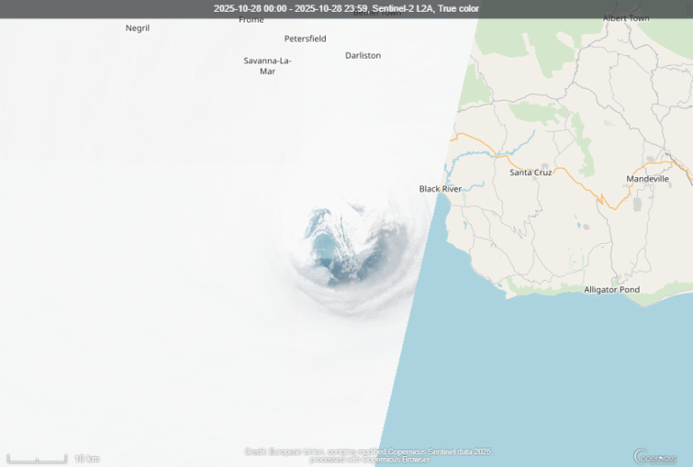
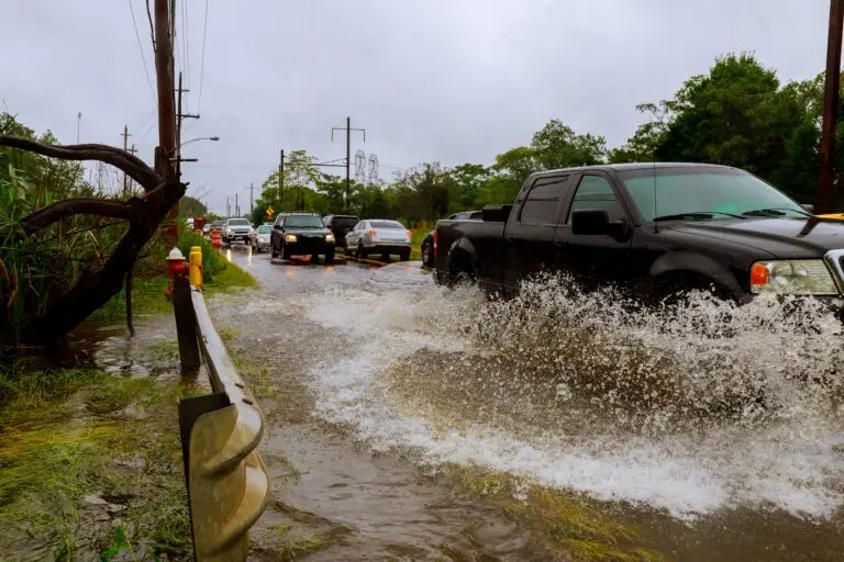
Hurricane Melissa, one of the strongest Atlantic storms ever recorded, has devastated Jamaica before moving toward Cuba and the Bahamas...

Iceland’s First Mosquitoes: Will They Survive?

For the first time in history, wild mosquitoes have been discovered in Iceland — a place long known as one of the few mosquito-free countries on Earth. The finding has surprised scientists and sparked...

How does La Niña affect the world in 2025?

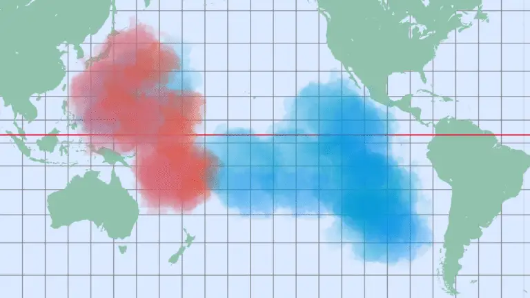
La Niña is back! But what exactly is La Niña? Around the globe, climate patterns swing between two powerful forces: El Niño and La Niña. These events influence weather everywhere — from devastating...

Greenland’s story: Epic History, Ancient Rituals & Daily Life

Greenland - The Island Everyone Suddenly Wants

What if one of the most remote places on Earth was suddenly at the center of global attention? Welcome to Greenland—a land carved by glaciers, grounded in ancient traditions, and recently the target of a surreal real estate proposal from a U.S. president. Once forgotten, this icy giant is now in the global spotlight. But why?

Let’s journey through the wild, untold story of Greenland—its heritage, culture, hidden resources, and the rising interest of world powers.


A Land Shaped by Ice and Time

Greenland’s Indigenous Beginnings

Long before flags and frontiers, Greenland was home to ancient cultures. The Saqqaq people arrived around 2500 BC, navigating Arctic extremes with remarkable adaptability. They were followed by the Dorset and later the ancestors of today’s Inuit, who established a deep-rooted cultural identity that still thrives today.


When the Vikings Came

Greenland’s Viking tale begins with Erik the Red—an outlaw from Norway who turned exile into opportunity. After being banished from Iceland, he discovered and named Greenland, possibly as a clever marketing trick. Norse settlers founded communities like Brattahlid, but by the 15th century, they vanished—possibly victims of climate shifts, failed trade, and cultural rigidity.


Colonial Footprints and Missionary Movements

The Danish Era Begins

In 1721, Danish missionary Hans Egede set sail to rediscover the lost Norse Christians. Instead, he found thriving Inuit communities. This sparked centuries of Danish colonial presence. By 1814, Greenland was formally declared a Danish colony through the Treaty of Kiel, setting the stage for modern governance.


Cultural Identity in the Arctic

Living Traditions and Languages

Today, about 90% of Greenland’s population is Inuit or mixed Inuit-Danish. Their language, Kalaallisut, echoes through towns and tundra. Cultural resilience is celebrated through traditional carvings like tupilaks and national festivities. June 21, Greenland’s National Day, transforms icy streets into vibrant scenes of flags, music, and community spirit.


Daily Life in an Isolated Paradise

No McDonald’s. No highways. Just generations of survival rooted in hunting, fishing, and family. Local food and customs define daily life, with seasonal celebrations adding a unique Arctic flavor to global holidays.


Geographical Wonders and Climate Challenges

The Landscape Beneath the Ice

Greenland’s terrain is anything but monotonous. With glacial valleys, ancient volcanoes like those on the Geikie Plateau, and fjords shaped by ice, it’s a land sculpted over millennia. Despite being the world’s largest island, it’s sparsely populated, with only about 56,000 residents clustered along the ice-free coast.


The Melting Glacier Crisis

Every year, over 200 billion tons of ice disappear from Greenland. This melt influences global sea levels, ocean currents, and climate patterns. Greenland may seem quiet, but it’s a pulse point for the planet’s future.


A Hidden Economic Powerhouse

Current Economic Landscape

Fishing, especially shrimp and halibut, remains Greenland’s economic backbone. Denmark provides substantial financial support, helping maintain infrastructure in this vast and rugged territory.


The Treasure Under the Ice

But beneath Greenland’s surface lies immense potential: uranium, iron ore, rare earth elements, and even gold. With ice retreating due to climate change, these resources are becoming more accessible. International interest from countries like China, Canada, and Australia is growing rapidly. There’s also oil and gas offshore, making Greenland a tantalizing prize for future energy strategies.


Global Eyes on Greenland

The Trump Proposal: Greenland for Sale?

In 2019, President Trump floated the idea of purchasing Greenland—a proposal that shocked the world. Denmark quickly dismissed it as absurd, and Greenland responded with a clear message: “We’re open for business, not for sale.”


Why Everyone Cares

Greenland’s strategic location between North America and Europe, adjacent to the Arctic, makes it a geopolitical hotspot. As the Arctic melts, new shipping routes and military implications emerge, attracting global attention from the U.S., Russia, and China.


Autonomy and the Road to Independence

Greenland’s Political Status Today

Since 2009, Greenland has held broad autonomy over domestic affairs. Denmark still oversees defense and foreign policy, but Greenland’s political voice is gaining volume, with many calling for eventual independence.


The Future of Greenland

Independence isn’t straightforward. The economy is still developing, infrastructure is sparse, and climate change presents both challenges and opportunities. But with a rich cultural identity and growing global relevance, Greenland stands at a crossroads—between ancient heritage and modern ambition.


So Greenland is no longer just a frozen island—it’s a symbol of resilience, resource potential, and rising global influence. As nations look northward, this Arctic land may soon shape the world more than ever before.

Read more...

Greenland’s story: Epic History, Ancient Rituals & Daily Life

Discover why Greenland is drawing global attention—from ancient Inuit culture to rare earth treasures and geopolitical interest...

The Annexation of Hawaii

Hawaii is one of the most remote island chains in the world. It lies over 2,000 miles from the U.S. mainland and nearly 4,000 miles from Japan. Because of the island’s remote location, it has had a...

The Netherlands

The Netherlands, known for its flat terrain, windmills, and tulip fields, is a progressive European nation with a rich cultural heritage. Renowned for Amsterdam’s historic canals and vibrant...

Barberton Mountains

Barberton: Where Life on Earth First Began

Deep in the heart of Mpumalanga, South Africa, lies a place that transports you back to the very beginning of time. Barberton, often overlooked on the typical tourist route, holds a treasure far more valuable than gold — the story of how life on Earth began. With landscapes dating back 3.6 billion years, Barberton is more than just a destination. In fact, it serves as a living museum of Earth’s earliest history.


Welcome to the Barberton Makhonjwa Mountains

A Geological Time Machine

These majestic mountains are not only visually striking — they are ancient beyond imagination. In fact, the rocks that shape the Barberton Makhonjwa Mountains are over 3.6 billion years old, making them older than 75% of the Earth itself. This region is one of the few places on the planet where the original crust is still visible, virtually untouched by time.


Located near the border with Eswatini, the mountains stretch across a breathtaking landscape of lush valleys and dramatic peaks. As a result, they continue to attract both scientists and adventurers eager to uncover their secrets.


The Barberton Greenstone Belt

Volcanic and Sedimentary Origins

Barberton is home to the Barberton Greenstone Belt, a region shaped by ancient volcanic eruptions and sedimentary processes. Remarkably, these formations have remained incredibly well-preserved. In many places, you can still clearly see the original stone layers — each one acting as a timestamp in Earth’s formative years.


Global Scientific Importance

Because of this, scientists from around the world come here to study how the planet evolved. The belt offers unique insights into the development of the Earth’s crust and atmosphere, especially during a time when no continents had yet formed.


A Golden Discovery That Changed History

The 1884 Gold Rush

In 1884, Barberton captured the world’s attention when gold was discovered in the region. As a result, one of South Africa’s first major gold rushes was triggered, drawing thousands of hopeful prospectors. This gold rush not only transformed the local economy but also shaped the cultural identity of the town.


Mineral Wealth That Goes Beyond Gold

Even today, the area remains rich in valuable minerals. However, beyond its economic benefits, the true treasure lies beneath the surface — in ancient stones that continue to reveal secrets about our planet’s past.


The Cradle of Early Life

Microfossils and Ancient Lifeforms

Hidden deep within these ancient rocks are microfossils — the earliest known signs of life. These tiny, single-celled organisms have been perfectly preserved for billions of years. As a result, they offer vital clues about how life may have first emerged on Earth.


Rare Minerals Like Komatiite

Additionally, Barberton is one of the only regions on Earth where komatiite can be found. This rare volcanic rock was formed under extreme heat conditions that existed only in the planet’s earliest stages. Because of this, researchers rely on it to understand the Earth’s early mantle composition.


Recognized by the World: A UNESCO World Heritage Site

Awarded in 2018

Due to its exceptional geological value, the Barberton Makhonjwa Mountains were named a UNESCO World Heritage Site in 2018. This prestigious designation highlights not only the visual beauty of the region but also its crucial role in advancing our understanding of Earth’s origin.


What Makes Barberton a Must-Visit Destination?

Geological Tours and Education

For travelers, Barberton offers more than just scenery. Visitors can participate in guided geological tours that offer hands-on learning experiences. These programs aim to educate and inspire, while also promoting sustainable tourism.


Connecting With Earth’s Deep Past

Ultimately, standing in the Barberton Makhonjwa Mountains is a deeply humbling experience. You’re not just admiring a natural wonder — you’re engaging with the earliest chapters of Earth’s story, long before oxygen filled the skies or continents came to be.


Conclusion: Standing Where Life Once Began

In conclusion, Barberton isn’t just a place on a map — it’s a living time capsule. Whether you’re a scientist, a history lover, or simply a curious traveler, this ancient land offers a rare opportunity to connect with the origins of our planet. So, take a moment to stand where life once began, and let the story of Earth unfold beneath your feet.


FAQs

How old are the rocks in Barberton?
The rocks are approximately 3.6 billion years old, making them among the oldest found anywhere on Earth.


Can tourists visit the Barberton Makhonjwa Mountains?
Yes, guided tours and educational experiences are available for visitors, making it an accessible and enriching destination.


What makes Barberton a UNESCO site?
Its combination of ancient geological formations, preserved microfossils, and rare volcanic rocks gives it exceptional universal value.


What is komatiite and why is it rare?
Komatiite is a rare volcanic rock formed in Earth’s early, high-temperature environment. It provides vital clues about the planet’s internal structure billions of years ago.

Read more...

The 2,000 Year Search for the Source of the Nile River

The Nile River. Possibly the longest river in the world, but certainly the most storied in history. Without the Nile, the civilizaiton of Ancient Egypt would have never existed. To the Ancient Greeks...

The Krakatoa Volcanic Eruption of 1883 – The Loudest Sound Ever Heard?

In 1883, possibly the loudest sound ever heard, detonated in the Sunda Strait between Java and Sumatra, Indonesia. The source of this explosion? A volcano that has gone down in infamy. Over 36,000...

The Northwest Passage – The Quick Northern Sea Route That Never Was

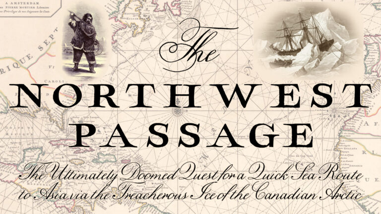
A sea-route that would connect Europe to the riches of Asia. Its there somewhere, over the north of the continent of America. So was the thought in the minds of thousands of merchants, explorers and...

The Annexation of Hawaii

How Hawaii Became the 50th state of the United States

From its explosive volcanic origins to its controversial path toward becoming the 50th state of the United States, Hawaii’s journey remains fascinating and complex. 


Hawaii is one of the most remote island chains in the world. It lies over 2,000 miles from the U.S. mainland and nearly 4,000 miles from Japan. Because of the island’s remote location, it has had a major impact on culture, biodiversity, and history.


Moreover, Hawaii offers more than stunning beaches and volcanic landscapes; it is a land forged by fire, defined by resilience, and transformed by centuries of exploration, conquest, and change. Let’s dive into the untold story of Hawaii.


The Volcanic Origin

A stationary hotspot deep within the Earth’s mantle created Hawaii. As the Pacific Plate drifted slowly over this hotspot, molten magma pierced through the crust and formed a series of volcanic islands. This geological marvel, known as the Hawaiian-Emperor seamount chain, stretches over 3,600 miles across the Pacific Ocean.


Today, Hawaii’s volcanoes remain active. Kīlauea, one of the world’s most active volcanoes, has erupted almost continuously for decades. Mauna Loa, the largest volcano on Earth, erupted most recently in 2022. As a result, Hawaii’s landscape constantly evolves, with new land formations regularly appearing along the coastlines. This living geology makes Hawaii one of the few places on Earth where you can witness island-building in real time.


Hawaii’s Diverse Climate

Furthermore, despite its relatively small size, Hawaii offers an incredible variety of climates. According to the Köppen climate classification system, the islands include four of the five major climate groups: tropical, arid, temperate, and polar.


The Köppen system classifies climates based on factors such as average temperature, precipitation, and seasonal patterns. In Hawaii, you can experience lush tropical rainforests, dry deserts, temperate highlands, and even polar conditions atop Mauna Kea’s summit within just a few miles. Consequently, this remarkable diversity fosters a rich range of ecosystems, supporting everything from vibrant coral reefs to alpine shrublands.


Early Life

Isolated by vast oceans, Hawaii became a sanctuary for unique plant and animal species. Birds, seeds, and insects arrived by wind, waves, or wings, creating an intricate web of life. Sadly, human settlement and invasive species endangered many native forms of life.


Additionally, long before European discovery, Polynesian voyagers navigated thousands of miles across the Pacific to settle in Hawaii. They built thriving communities based on fishing, farming, and intricate social systems. Each island developed distinct laws, religions, and traditions. Consequently, Hawaii’s cultural foundations were laid long before foreign influence arrived.


How Hawaii was formed

The world discovered Hawaii in 1778 when British explorer Captain James Cook landed on its shores. Additionally, following his arrival, European influence grew rapidly. Previously divided among independent chiefdoms, the islands experienced frequent conflicts.


Recognizing the need for unity, King Kamehameha I launched an ambitious campaign to consolidate power. Using European firearms and strategic alliances, he conquered neighboring islands. After his decisive victory at the Battle of Nuʻuanu, he unified Oahu. Furthermore, his diplomatic acumen led to the peaceful submission of Kauai and Niʻihau, where Chief Kaumuali’i agreed to become a vassal rather than engage in war.


Thus, in 1810, King Kamehameha I unified all major Hawaiian Islands under one rule. This achievement established the Kingdom of Hawaii and ushered in a period of stability and booming trade, positioning Hawaii as an important player in the Pacific.


The Overthrow of the Hawaiian Monarchy

By the 19th century, American missionaries and businessmen gained strong influence in Hawaiian affairs. Christianity, Western education, and sugarcane plantations transformed the islands. In 1887, the Bayonet Constitution stripped the monarchy of much of its authority, disenfranchising Native Hawaiians and transferring significant power to American and European residents.


Queen Liliʻuokalani ascended the throne in 1891 after her brother, King Kalākaua, died. She determined to restore the authority of the monarchy and drafted a new constitution aimed at empowering Native Hawaiians and reversing foreign influence. However, her efforts alarmed American businessmen and planters who feared losing their political and economic dominance.


In January 1893, a group called the “Committee of Safety,” composed largely of American residents, orchestrated a coup against Queen Liliʻuokalani. They enlisted support from U.S. Minister John L. Stevens, who ordered U.S. Marines to land in Honolulu under the pretext of protecting American lives and property. Consequently, facing overwhelming opposition and wanting to avoid bloodshed, the Queen temporarily surrendered her throne. She hoped that the U.S. government would right the injustice.


Nevertheless, despite President Grover Cleveland’s opposition to the coup and his call to restore the Queen, the provisional government led by Sanford B. Dole refused to relinquish power. As a result of political shifts in the U.S., particularly the election of pro-annexation President William McKinley, efforts to reinstate the monarchy failed. Thus, the overthrow ended Native Hawaiian sovereignty and paved the way for Hawaii’s eventual annexation by the United States.


Annexation of Hawaii

After the monarchy’s fall, Sanford B. Dole led Hawaii as the Republic of Hawaii. Although Native Hawaiians strongly resisted, the new government sought annexation by the United States. Strategic concerns during the Spanish-American War made Hawaii a critical military and naval asset. Therefore, Congress passed the Newlands Resolution in 1898, formally annexing Hawaii without the consent of the Hawaiian people. Many Hawaiians protested the annexation, but American policymakers largely ignored their voices.


The territorial status brought significant changes. American businesses expanded their control over the islands’ economy, especially in sugar and pineapple plantations. Meanwhile, the U.S. military established a stronger presence, recognizing Hawaii’s strategic position between America and Asia.


World War II further emphasized Hawaii’s importance. Japan’s devastating attack on Pearl Harbor on December 7, 1941, thrust the United States into the global conflict. Authorities placed Hawaii under martial law, and military governance replaced civilian rule throughout the war. Infrastructure, ports, and airfields expanded massively, turning Hawaii into the linchpin of U.S. military operations in the Pacific.


How and when Hawaii Became a State

After the war, Hawaii’s population became more closely tied to American identity. Economic prosperity, tourism growth, and the civil rights movement fueled a drive for full statehood. After years of advocacy, Congress passed the Hawaii Admission Act.


Consequently, Hawaii officially became the 50th state of the United States on August 21, 1959, after an overwhelming 94% of voters approved statehood during a referendum.

Despite this strong majority, opposition to statehood persisted. Many Native Hawaiians and other groups opposed the referendum. Their resistance stemmed from a desire to restore Hawaiian sovereignty, grievances over the illegal overthrow of the monarchy, and concerns about cultural preservation. Some critics also argued that the referendum’s structure did not offer independence as an option. As a result, while statehood brought economic benefits and political representation, it also deepened longstanding tensions regarding Hawaii’s identity and autonomy.


Hawaii Nowadays

Modern Hawaii thrives as a bustling hub for tourism and military operations. However, it faces significant challenges. High living costs, housing shortages, and ongoing struggles for Native Hawaiian rights highlight the tensions between progress and heritage.


Indeed, although President Bill Clinton signed the Apology Resolution in 1993 acknowledging past injustices, many Native Hawaiians continue to advocate for greater sovereignty and cultural preservation.


Thus, Hawaii today represents a complex blend of beauty, resilience, and ongoing cultural revival.


Want to dive deeper into Hawaii’s fascinating story?

👉 Watch our full video here: Explore Hawaii’s History on YouTube

Read more...

Greenland’s story: Epic History, Ancient Rituals & Daily Life

Discover why Greenland is drawing global attention—from ancient Inuit culture to rare earth treasures and geopolitical interest...

The Annexation of Hawaii

Hawaii is one of the most remote island chains in the world. It lies over 2,000 miles from the U.S. mainland and nearly 4,000 miles from Japan. Because of the island’s remote location, it has had a...

The Netherlands

The Netherlands, known for its flat terrain, windmills, and tulip fields, is a progressive European nation with a rich cultural heritage. Renowned for Amsterdam’s historic canals and vibrant...

How a Lighthouse Changed a Border

How a lighthouse changed a border

Did you know that a small lighthouse once forced Sweden and Finland to change their border?


Märket is a tiny, rocky island located in the northern Baltic Sea, shared by Sweden and Finland. The island, which measures only about 300 meters long, has a fascinating history—especially when it comes to borders. In 1885, Finland built a lighthouse on the island to help guide ships through the treacherous waters of the archipelago. However, there was one significant problem: the lighthouse was accidentally constructed on the Swedish side of the island.


This unintentional mistake set off a series of diplomatic negotiations. In 1985, nearly 100 years later, Sweden and Finland agreed to resolve the situation by redrawing their border, but instead of a straight line across the island, the new boundary zigzagged around the lighthouse, ensuring that the structure remained under Finnish control while preventing Sweden from losing any land.


What makes this case particularly intriguing is that Märket is one of the few places in the world where a border was altered specifically due to the location of a building. The unique decision to modify the border just for the lighthouse is a rare example of countries compromising over an insignificant geographical feature to maintain diplomatic relations.


Märket’s lighthouse continues to be a symbol of cooperation between Sweden and Finland, a reminder of how even the smallest of structures can lead to significant changes in international boundaries. The island now serves as a shared symbol of the two nations’ long history of peaceful coexistence.


So, do you think the countries made the right decision to change the border just for a lighthouse? Would you have handled it the same way? Let us know your thoughts in the comments below!

Exploring Calakmul: The ancient mayan city hidden in the heart of the Mexican jungle

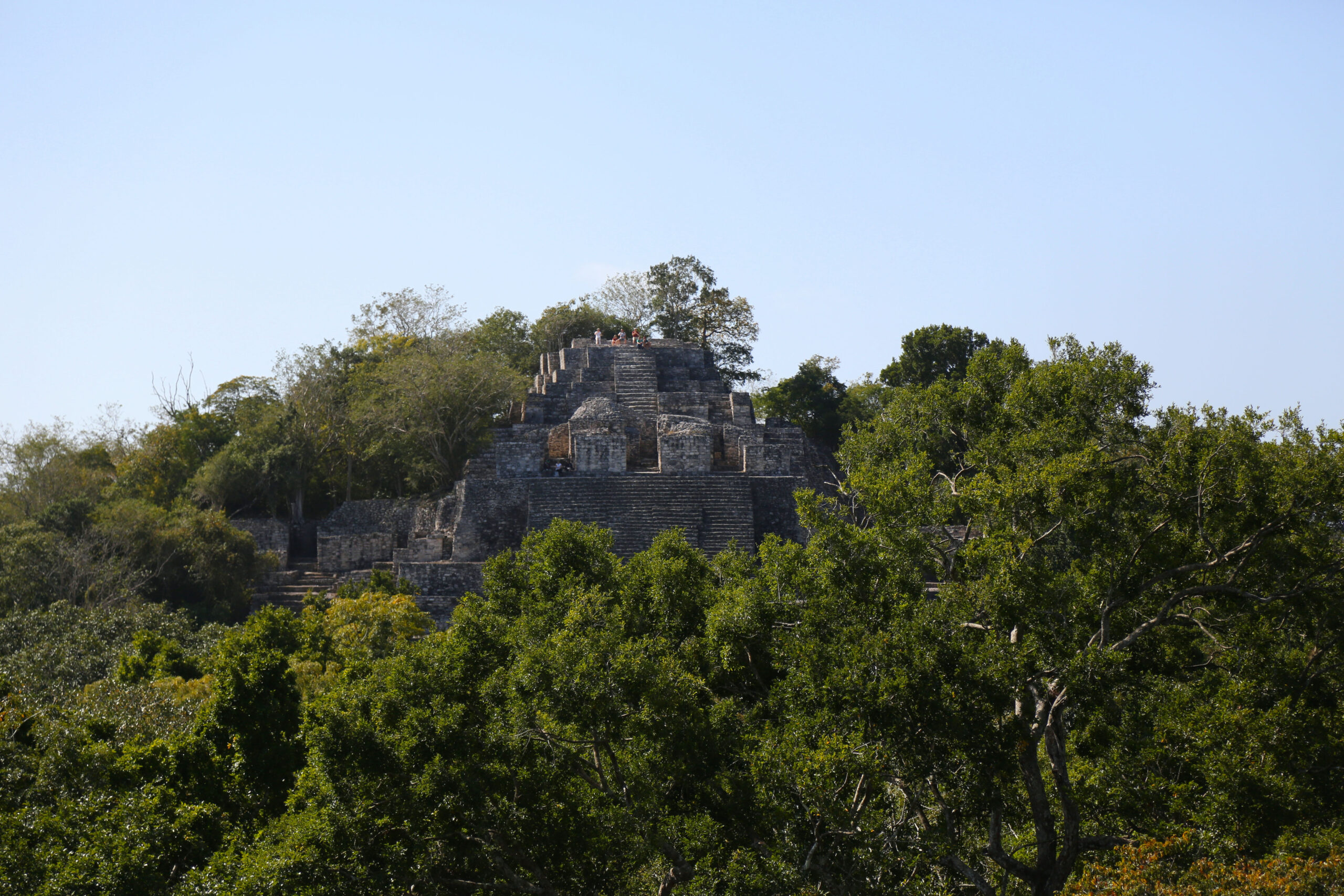
Nestled deep within the dense jungles of the Mexican state of Campeche lies Calakmul, one of the largest and most powerful ancient Mayan cities ever discovered. This remote and awe-inspiring archaeological site offers a glimpse into the rich history and cultural heritage of the Mayan civilization. With its towering pyramids, expansive plazas, and intricate hieroglyphics, Calakmul is a testament to the ingenuity and sophistication of the Mayan people.

A brief hstory of Calakmul

Calakmul, whose name means “City of the Two Adjacent Pyramids,” was once a thriving metropolis at the heart of the Mayan world. It was one of the most influential cities during the Classic period (250-900 AD), rivaling the famous Tikal in Guatemala. The city served as a major political and economic center, with a population that likely exceeded 50,000 at its peak. Its strategic location allowed it to control vast trade networks and wield significant influence over neighboring regions.

The city was first discovered in 1931 by American biologist Cyrus L. Lundell, who stumbled upon the ruins while conducting a botanical expedition. Since then, extensive excavations have revealed a wealth of information about Calakmul’s history, culture, and architecture. In 2002, the site was declared a UNESCO World Heritage Site, recognizing its outstanding universal value and ensuring its preservation for future generations.

Architectural marvels of Calakmul

One of the most striking features of Calakmul is its monumental architecture. The city is home to over 6,500 structures, including towering pyramids, grand palaces, and sprawling plazas. The two largest pyramids, known as Structure I and Structure II, dominate the skyline and offer breathtaking views of the surrounding jungle.

  • Structure II: Standing at 45 meters (148 feet) tall, Structure II is the tallest and most impressive pyramid in Calakmul. It consists of multiple tiers, each adorned with intricate carvings and hieroglyphics that tell the story of the city’s rulers and their achievements. Climbing to the top of Structure II provides a panoramic view of the dense jungle canopy, a sight that is both humbling and awe-inspiring.
  • Structure I: Slightly smaller than Structure II but no less significant, Structure I is another remarkable example of Mayan engineering and artistry. Its steep steps and well-preserved carvings provide valuable insights into the religious and ceremonial practices of the ancient Mayans.

The rich cultural heritage of Calakmul

Beyond its architectural grandeur, Calakmul is also renowned for its rich cultural heritage. The city’s numerous stelae—tall, sculpted stone slabs—are adorned with detailed hieroglyphics that chronicle the lives of its rulers, battles, and alliances. These inscriptions have been invaluable in piecing together the history of the Mayan civilization and understanding the complex social and political dynamics of the time.

Calakmul was also a center for artistic and intellectual activity. The city produced exquisite pottery, intricate jade carvings, and elaborate murals that depict scenes from daily life, religious rituals, and mythological stories. These artifacts provide a fascinating glimpse into the creativity and sophistication of the Mayan people.

Preserving Calakmul for future generations

Today, Calakmul is a protected archaeological site, with ongoing efforts to preserve its structures and artifacts. The remote location of the city has helped shield it from the impacts of modern development, allowing visitors to experience the site in a relatively untouched state. However, the preservation of Calakmul is an ongoing challenge, requiring the dedication and collaboration of archaeologists, conservationists, and local communities.

For those who venture into the heart of the Mexican jungle to explore Calakmul, the journey is well worth the effort. Walking among the ancient ruins, surrounded by the sounds of the jungle and the echoes of a bygone era, is a profoundly moving experience. Calakmul stands as a testament to the enduring legacy of the Mayan civilization and a reminder of the incredible achievements of our ancestors.

Visiting Calakmul

Reaching Calakmul is an adventure in itself, involving a journey through dense jungle and often guided tours to navigate the site. The nearest town, Xpujil, serves as a base for visitors and offers accommodations and amenities. From there, it’s a 60-kilometer drive through the Calakmul Biosphere Reserve to reach the site.

For those interested in history, archaeology, and the natural beauty of the Mexican jungle, a visit to Calakmul is a must. It’s an opportunity to step back in time and immerse oneself in the grandeur of an ancient civilization, to walk in the footsteps of the Mayans, and to marvel at the architectural and cultural achievements of one of the world’s greatest ancient cities.

In conclusion, Calakmul is not just a hidden gem of the Mayan world; it’s a treasure trove of history and culture waiting to be discovered. Its remote location and well-preserved ruins offer a unique and authentic glimpse into the past, making it a must-visit destination for anyone interested in the rich tapestry of human history.