What Is the Köppen Climate Classification System? Global Zones Made Simple
What Is the Köppen System and Why It Matters
The Köppen Climate Classification System is a globally recognized method for categorizing different climate types. It uses two basic measurements: average temperature and average precipitation. By analyzing these, the system groups Earth’s climates into clear, understandable categories.
This framework was first introduced by Wladimir Köppen, a German climatologist, and later refined by Rudolf Geiger. Together, they transformed a complex set of climate data into a practical tool. Today, it’s widely used in education, agriculture, urban planning, and climate science.
What makes the Köppen system so powerful is its balance between scientific precision and usability. It offers a quick way to understand global weather patterns without needing complex tools. Whether you are a student, researcher, or policymaker, the Köppen system gives you an easy way to interpret climate data and apply it to real-world problems.
Why We Classify Climate: Purpose and Benefits
Classifying climates serves many purposes. Humans have always tried to categorize nature—from plants and animals to minerals and landscapes. When we classify climate, we turn weather patterns into something organized and predictable.
This system helps us make informed decisions. For example, farmers use it to choose crops suited to their region. City planners use it to design buildings that withstand local weather. Scientists study it to track climate change over time.
But there’s more than just practical value. Classifying climate zones also helps us understand how climate affects culture, biodiversity, and even human migration. By comparing different climate regions, we can appreciate how environments shape societies and ecosystems in unique ways.
Global Climate Zones from Equator to Poles
The Köppen system divides the world into five major climate groups, labeled with the letters A through E. These categories reflect the global pattern of temperature and precipitation from the equator to the poles.
Each group is broken down into subtypes, which add detail by describing seasonal rainfall patterns and temperature differences. This results in letter combinations like Csa or Dfb, which at first seem complex but actually provide a compact summary of a region’s climate.
By learning the meaning behind each letter, you can quickly identify what kind of weather to expect in any part of the world. This structure makes the Köppen system both easy to use and widely applicable in fields like education, meteorology, and environmental planning.
Group A: Tropical Climates
Tropical climates are found near the equator, where temperatures stay high throughout the year. These regions also receive abundant rainfall, supporting lush vegetation and rich biodiversity.
-
Af (Tropical rainforest): These areas experience heavy rainfall every month. The climate supports dense forests with tall trees, vines, and a variety of wildlife.
-
Am (Tropical monsoon): This subtype has a short dry season followed by intense rain. Monsoons dramatically affect agriculture and daily life in these regions.
-
Aw/As (Tropical savanna): Here, rainfall is seasonal. Wet and dry periods alternate, leading to landscapes with a mix of grasslands and scattered trees.
Tropical regions are often home to high population densities due to their fertile land and predictable seasons. However, they’re also vulnerable to flooding and drought, depending on yearly climate fluctuations.
Group B: Dry Climates
Dry climates are defined by a lack of rainfall. In these zones, evaporation exceeds precipitation, making water a scarce and precious resource.
-
BWh (Hot desert): Found in places like the Sahara, these areas are extremely hot during the day and cold at night. The landscape is mostly bare, with little vegetation.
-
BWk (Cold desert): These regions are dry but colder, often located at high elevations or inland. They have more seasonal variation and occasional winter frost.
-
BSh/BSk (Semi-arid): These areas receive slightly more rain, allowing for grasses and small shrubs to survive. They often serve as transition zones between deserts and more temperate areas.
People living in dry climates often rely on irrigation, water conservation, and climate-adaptive crops. These adaptations show how societies can thrive even under challenging environmental conditions.
Group C: Temperate Climates
Temperate zones offer moderate weather with clearly defined seasons. These areas typically have warm summers and cool winters, with rainfall spread throughout the year or focused in certain seasons.
-
Csa/Csb (Mediterranean): These climates are known for dry summers and wet winters. Common in southern Europe and coastal California, they support crops like olives, grapes, and wheat.
-
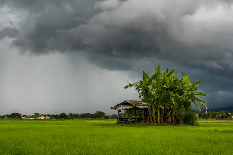
Cfa (Humid subtropical): Found in places like the southeastern United States, this subtype has hot, humid summers and year-round rainfall. It supports dense forests and is ideal for agriculture.
-
Cfb/Cfc (Oceanic): These climates feature mild temperatures all year and frequent rain. Coastal regions in western Europe often have this climate, creating green, fertile landscapes.
Temperate zones are often densely populated due to their favorable living conditions, long growing seasons, and steady access to water.
Group D: Continental Climates
Continental climates occur inland, where the ocean’s moderating effect is absent. This results in more extreme seasonal changes—hot summers and very cold winters.
-
Dfa/Dfb: These climates feature year-round precipitation, with summers that range from warm to hot, and winters that can bring heavy snow and freezing temperatures.
-
Dfc/Dfd (Subarctic): Found in Canada and Siberia, these areas endure long, bitterly cold winters and short, mild summers. The vegetation is mainly coniferous forest.
Living in continental climates requires careful planning. Buildings need strong insulation, and people often grow crops during short summer windows and store food for the long winters.
Group E: Polar Climates
Polar climates are the coldest on Earth, with very low temperatures and little to no precipitation.
-
ET (Tundra): These regions have brief summers where temperatures rise just above freezing. Small plants like mosses and grasses grow during this window.
-
EF (Ice cap): Found in Antarctica and parts of Greenland, these areas remain below freezing all year. No vegetation survives, and life is extremely limited.
These climates are important to climate research because they are highly sensitive to global warming. Even small temperature increases can lead to melting ice and rising sea levels, impacting the entire planet.
How Köppen Codes Work: A Simple System With Big Value
Each Köppen code is like a shortcut that describes a region’s climate. The structure includes:
-
First letter (A–E): Main climate group
-
Second letter: Seasonal rainfall pattern
-
Third letter (optional): Temperature variation
For example:
-
Csa: Hot-summer Mediterranean climate
-
Dfb: Humid continental with warm summers and cold winters
These codes are useful because they condense complex data into an easy format. They’re used in textbooks, climate reports, and even weather apps to describe climates at a glance.
Real-World Uses: Why the Köppen System Still Matters
The Köppen system isn’t just for scientists—it has everyday applications. Teachers use it to explain global climates. Farmers use it to select the best crops. City planners refer to it when designing buildings suited for local weather.
As the climate changes, Köppen zones help track shifts in temperature and rainfall. For example, some areas once classified as temperate are becoming more dry. This has major implications for agriculture, biodiversity, and water management. By using this system, we can monitor trends, adapt to changes, and make informed decisions that benefit both people and the planet.
Conclusion
The Köppen Climate Classification System turns global weather into a clear, understandable structure. From tropical rainforests to polar ice caps, each code tells a story about temperature, rainfall, and life. Whether you’re studying geography or planning a city, this system gives you the tools to understand climate—and respond to it—with confidence.
Read more